සැකිල්ල:තොරතුරු කොටුව යුනෙස්කෝ ලෝක උරුම අඩවි/doc
| This is a documentation subpage for සැකිල්ල:තොරතුරු කොටුව යුනෙස්කෝ ලෝක උරුම අඩවි. It may contain usage information, categories and other content that is not part of the original සැකිල්ල page. |
| මෙම සැකිල්ල ලුවා භාවිතා කරයි: |
Syntax
සංස්කරණය{{Infobox UNESCO World Heritage Site
| WHS = <!-- name as inscribed on the World Heritage List: use with the STAND-ALONE version of this template -->
| Official_name = <!-- name as inscribed on the World Heritage List: use ONLY with the embedded version of this template, if it doesn't matches the name of the template it is in: see [[Giza pyramid complex]] for an example-->
| image = <!-- optional -->
| image_size = <!-- optional -->
| caption = <!-- optional -->
| Part_of = <!-- optional: when the article subject is part of a WHS listing, not a full one, e.g. one church in a series of churches -->
| Includes = <!-- optional: when a group of subjects together form this WHS; avoid long listings, in which case it is better to summarize or to omit the parameter altogether-->
| Location = <!-- optional -->
| Criteria = <!-- Cultural, Natural or Mixed, plus roman numbers -->
| ID =
| Coordinates = <!-- optional; use {{coord}} -->
| Year =
| Extension = <!-- optional -->
| Danger = <!-- optional -->
| Area = <!-- optional -->
| Buffer_zone = <!-- optional -->
| Website = <!-- optional -->
| locmapin = <!-- optional -->
| map_caption = <!-- optional -->
| map_width = <!-- optional -->
| relief = <!-- "1" for relief map - if available -->
| child = <!-- optional; set to "yes" to embed this infobox within another infobox -->
| embedded = <!-- optional; use to embed another infobox template within this one, e.g. {{Location map many}} -->
}}
Pre-loading Wikidata values
සංස්කරණයThe listing below proposes to import Wikidata values (called "claims" at Wikidata) and convert them to static local data, with the subst: technique.
Pre-loading Wikidata values in this fashion would often be unsuccessful due to failing Wikidata claims for the item: it is up to the editor importing the claims to check whether the claim is correct and appropriate for the infobox.
| several values need to be reformatted after loading with this method, see comments starting with three !!! in the list below |
The preload-list can be used for a first implementation of this template in an article. Separate parameter substitutions can be used to complement incomplete parameter sets in a previously implemented infobox.
මෙම ලැයිස්තුව අසම්පූර්ණ එකකි; කරුණු එක්කිරීම මගින් ඔබට ද උදව් විය හැක. |
{{Infobox UNESCO World Heritage Site
| child         =
| WHS           = {{subst:Wikidata|qualifier|P1435|P1448}}<!-- leave empty, unless for stand-alone infoboxes that need a title different from the article title -->
| image         = {{subst:Wikidata|property|P18}}<!-- !!! remove "[[File:" and "]]" wrapping the image name or it is impossible to manage the image size -->
| image_upright = 1.2
| caption       = {{subst:Wikidata|qualifier|P18|P2096}}
| official_name = {{subst:Wikidata|qualifier|P1435|P1448}}<!-- leave empty unless the official WHS name is different from the title of the infobox -->
| location      = {{subst:Wikidata|properties|linked|P706}}, {{subst:Wikidata|properties|linked|P276}}, {{subst:Wikidata|properties|linked|P131}}, {{subst:Wikidata|property|linked|P17}}, {{subst:Wikidata|property|linked|P30}}<!-- make selection: P17 (country) and possibly P131 (administrative subdivision of country) suffice in most cases -->
| part_of       = {{subst:Wikidata|properties|linked|P361}}
| includes      = {{subst:Wikidata|properties|linked|P527}}<!--replace by summary if the list of sub-entities is too large or incomplete-->
| criteria      = {{UNESCO WHS type|{{subst:Wikidata|properties|P2614}}}}{{subst:Wikidata|properties|P2614}}
| ID            = {{subst:Wikidata|property|P757}}
| coordinates   = {{subst:Wikidata|property|linked|P625}}<!-- !!! convert to {{coord|...|...|format=dms}} -->
| year          = {{subst:Wikidata|qualifier|P1435|P580}}
| extension     = {{subst:Wikidata|qualifiers|P793|P585}}
| danger        = {{#if: {{subst:Wikidata|qualifiers|P793|P580}}|{{subst:Wikidata|qualifiers|P793|P580}} -|}}{{#if: {{subst:Wikidata|qualifiers|P793|P582}}|- {{subst:Wikidata|qualifiers|P793|P582}}|}}
| area          = {{subst:Wikidata|property|P2046}}<!-- {{convert|...|ha|acre|abbr=on}} or similar with other units recommended -->{{subst:wikidata|reference|P2046}}
| buffer_zone   =
| website       = {{URL|{{subst:Wikidata|property|P856}}}}
| embedded      =
| locmapin      = {{subst:Wikidata|property|P17}}
| map_caption   =
}}
Notes
සංස්කරණය- If the Heritage Site has multiple locations across a country or continent, use the embedded template {{Location map many}} as in example 4.
- If the template is not used as an embedded template, always use the "WHS" parameter. If the template is embedded, and the official name at the Unesco site doesn't match the name of the template it is used in, use "Official_name". See Giza pyramid complex for an example of the second use.
- "Type" is kept as a parameter for backwards compatibility only, and should preferably not be used.
Coordinates
සංස්කරණයFor coordinates, use {{coord}} with display=inline,title. Please do not be overly precise.
Examples
සංස්කරණය- Example 1
| යුනෙස්කෝ ලෝක උරුම අඩවිය | |
|---|---|
| පිහිටුම | Nepal |
| නිර්ණායකය | Cultural: iii, iv, vi |
| මූලාශ්ර | 121 |
| අභිලේඛනය | 1979 (3 වන සැසිය) |
| දිගුව | 2006 |
| අන්තරායට ලක් වූ | 2003-2007 |
This example has no image:
{{Infobox UNESCO World Heritage Site
| WHS         = Kathmandu Valley
| Location    = [[Nepal]]
| Criteria    = Cultural: iii, iv, vi
| ID          = 121
| Year        = 1979
| Danger      = 2003-2007
| Extension   = 2006
}}
- Example 2
| යුනෙස්කෝ ලෝක උරුම අඩවිය | |
|---|---|
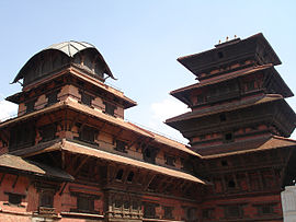
 The Kathmandu Darbar Square | |
| පිහිටුම | Nepal |
| නිර්ණායකය | Cultural: iii, iv, vi |
| මූලාශ්ර | 121 |
| අභිලේඛනය | 1979 (3 වන සැසිය) |
| දිගුව | 2006 |
| අන්තරායට ලක් වූ | 2003-2007 |
This example uses an image of width 270px, and the alt and caption parameters:
{{Infobox UNESCO World Heritage Site
| WHS         = Kathmandu Valley
| image       = Basantapurpalace.JPG
| image_size  = 270px
| alt         = The Kathmandu Darbar Square
| caption     = The Kathmandu Darbar Square
| Location    = [[Nepal]]
| Criteria    = Cultural: iii, iv, vi
| ID          = 121
| Year        = 1979
| Danger      = 2003-2007
| Extension   = 2006
}}
- Example 3
| යුනෙස්කෝ ලෝක උරුම අඩවිය | |
|---|---|
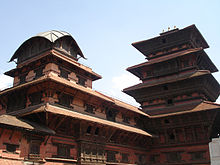
 The Kathmandu Darbar Square | |
| පිහිටුම | Nepal |
| නිර්ණායකය | Cultural: iii, iv, vi |
| මූලාශ්ර | 121 |
| අභිලේඛනය | 1979 (3 වන සැසිය) |
| දිගුව | 2006 |
| අන්තරායට ලක් වූ | 2003-2007 |
| භූමිය | 167.37 ha |
| අවරෝධක කලාපය | 70.29 ha |
| ඛණ්ඩාංක | 27°42′14″N 85°18′32″E / 27.704°N 85.309°E |
This example uses the default image width, and a location map:
{{Infobox UNESCO World Heritage Site
| WHS         = Kathmandu Valley
| image       = Basantapurpalace.JPG
| alt         = The Kathmandu Darbar Square
| caption     = The Kathmandu Darbar Square
| Location    = [[Nepal]]
| Criteria    = Cultural: iii, iv, vi
| ID          = 121
| Year        = 1979
| Danger      = 2003-2007
| Extension   = 2006
| Area        = 167.37 ha
| Buffer_zone = 70.29 ha
| locmapin    = Nepal
| coordinates = {{coord|27.704|85.309}}
| map_caption = Location in Nepal
}}
- Example 4
| යුනෙස්කෝ ලෝක උරුම අඩවිය | |
|---|---|
 Bauhaus building in Dessau | |
| පිහිටුම | Germany |
| නිර්ණායකය | Cultural: ii, iv, vi |
| මූලාශ්ර | 729 |
| අභිලේඛනය | 1996 (20 වන සැසිය) |
| දිගුව | 2017 |
| භූමිය | 8.1614 ha |
| අවරෝධක කලාපය | 59.26 ha |
This example uses an embedded template for the location map, allowing an unlimited number of clickable locations:
{{Infobox UNESCO World Heritage Site
|WHS          = Bauhaus and its Sites in Weimar, Dessau and Bernau
|Image        = [[File:Bundesarchiv Bild 183-1987-0204-305, Dessau, Bauhaus.jpg|250px|Bauhaus Dessau Workshop]]
|imagecaption = Bauhaus building in Dessau
|Location     = Germany
|Criteria     = Cultural: ii, iv, vi
|ID           = 729
|Year         = 1996
|Extension    = 2017
|Area         =  8.1614 ha
|Buffer_zone  =  59.26 ha
|embedded     =
{{Location map many|border=infobox
| Germany
| caption     = Bauhaus sites: 1 = Weimar, 2 = Dessau, 3 = Bernau
| label1      = 1
| link1       = Weimar
| coordinates1=  {{coord|50|58|29|N|11|19|46|E}}
| label2      = 2
| link2       = Dessau
| coordinates2= {{coord|51|50|18|N|12|13|38|E}}
| label3      = 3
| link3       = Bernau bei Berlin
| coordinates3= {{coord|52|42|24|N|13|32|39|E}}
}}
}}
Microformat
සංස්කරණයThe HTML markup produced by this template includes an hCard microformat, which makes the place-name and location parsable by computers, either acting automatically to catalogue articles across Wikipedia, or via a browser tool operated by a person, to (for example) add the subject to an address book. Within the hCard is a Geo microformat, which additionally makes the coordinates (latitude & longitude) parsable, so that they can be, say, looked up on a map, or downloaded to a GPS unit. For more information about the use of microformats on Wikipedia, please see the microformat project.
Sub-templates
සංස්කරණයIf the place or venue has "established", "founded", "opened" or similar dates, use {{start date}} for the earliest of those dates unless the date is before 1583 CE.
If it has a URL, use {{URL}}.
Please do not remove instances of these sub-templates.
Classes
සංස්කරණයhCard uses HTML classes including:
- adr
- agent
- category
- county-name
- extended-address
- fn
- label
- locality
- nickname
- note
- org
- region
- street-address
- uid
- url
- vcard
Geo is produced by calling {{coord}}, and uses HTML classes:
- geo
- latitude
- longitude
Please do not rename or remove these classes nor collapse nested elements which use them.
Precision
සංස්කරණයWhen giving coordinates, please use an appropriate level of precision. Do not use {{coord}}'s |name= parameter.
An Infobox for World Heritage Sites
| Parameter | Description | Type | Status | |
|---|---|---|---|---|
| Name | WHS Name | name as inscribed on the World Heritage List | String | required |
| Image | image Image | An image of the site | String | optional |
| Caption | caption Caption imagecaption | The image caption | String | optional |
| Location | Location | Location of the site | String | optional |
| Criteria | Criteria | The designated criteria i, ... ix or x | String | required |
| ID | ID | The reference number | Number | required |
| Link | Link | A link, only used if no ID | String | optional |
| Coordinates | Coordinates coordinates | Use the {{coord}} template with display=inline, do not be overly precise. | String | optional |
| Year | Year | Year site was listed | String | optional |
| Session | Session | Session site was inscribed: 1st – 40th | String | optional |
| Extension | Extension | Extension | String | optional |
| Danger | Danger | Period site has been in danger | String | optional |
| Location map | locmapin | Name of Location map to use, typically a country name | String | optional |
| Map caption | map_caption | Caption to use with the map | String | optional |
| Map width | map_width | Width of displayed the map | Number | optional |
| Relief | relief | Use '1' for relief map - if available | Number | optional |
| Child | child | set to 'yes' to embed this infobox within another infobox | String | optional |
| Embedded | embedded | Use to embed another infobox template within this one, e.g. {{Infobox mountain}} | String | optional |
Tracking categories
සංස්කරණයSee also
සංස්කරණය- {{Infobox intangible heritage}}
- {{Intangible Heritage Azerbaijan}} navbox
- {{Intangible Heritage Iran}} navbox
- {{Infobox UNESCO World Heritage Site}}
- {{Lists of World Heritage Sites}} navbox
- {{World Heritage Sites in Bulgaria}}
- {{UNESCO Collection}}
- {{UNESCO Oral and Intangible Eastern Europe}}
- {{UNESCO Oral and Intangible music}}
- {{UNESCO Representative List of the Intangible Cultural Heritage of Humanity}}

