සැකිල්ල:ප්‍රවාහන නැවතුම්පොල තොරතුරු පැනලය/testcases

Template:Infobox station/testcases Template:Infobox station/testcases2  
Side by side comparison
{{ප්‍රවාහන නැවතුම්පොල තොරතුරු පැනලය}}{{ප්‍රවාහන නැවතුම්පොල තොරතුරු පැනලය/sandbox}}
{{{name}}}

{{{native_name}}}
Bus interchange
Trolleybus
Mainline rail interchange
Express train
Airport interchange
Handicapped/disabled access
{{{type}}}
[[File:{{{image}}}|frameless|alt={{{alt}}}|upright={{{image_upright}}}]]
{{{caption}}}
{{{mlanguage}}}
සාමාන්‍ය තොරතුරු
Other names{{{other_name}}}
පිහිටි ස්ථානය{{{address}}}
{{{borough}}}
{{{country}}}
භූගෝලීය ඛණ්ඩාංක0°N 0°E / 0°N 0°E / 0; 0
උන්නතාංශය{{{elevation}}}
හිමිකාරීත්වය{{{owned}}}
ක්‍රියාකරු{{{operator}}}
Transit authority{{{transit_authority}}}
දුම්රිය මාර්ග(ය){{{lines}}}
දුර{{{distance}}}
වේදිකා ගණන{{{platforms}}}
දුම්රිය මාර්ග ගණන{{{tracks}}}
Train operators{{{train_operators}}}
Bus routes{{{bus_routes}}}
Bus stands{{{bus_stands}}}
Bus operators{{{bus_operators}}}
ප්‍රවාහන සබදතා{{{connections}}}
Construction
Structure type{{{structure}}}
Depth{{{depth}}}
Platform levels{{{levels}}}
Parking{{{parking}}}
Bicycle facilities{{{bicycle}}}
Accessible{{{disabled}}}
ගෘහ නිර්මාණ ශිල්පී{{{architect}}}
Architectural style{{{architectural_style}}}
වෙනත් තොරතුරු
තත්ත්වය{{{status}}}
දුම්රිය ස්ථාන කේතය{{{code}}}
IATA code{{{iata}}}
ගාස්තු කලාපය{{{zone}}}
Classification{{{classification}}}
වෙබ් අඩවිය{{{website}}}
ඉතිහාසය
විවෘතය{{{opened}}}
Opening{{{opening}}}
වසා දැමීම{{{closed}}}
ප්‍රතිස්ථාපනය{{{rebuilt}}}
විද්‍යුතනය{{{electrified}}}
පෙර පැවති නාම{{{former}}}
Original company{{{original}}}
Pre-grouping{{{pregroup}}}
Post-grouping{{{postgroup}}}
Pre-nationalisation{{{prenational}}}
Key dates
{{{years}}}{{{events}}}
{{{years1}}}{{{events1}}}
{{{years11}}}{{{events11}}}
Passengers
Passengers ({{{pass_year}}}){{{passengers}}} Steady 0% ({{{pass_system}}})
Rank{{{pass_rank}}}
{{{mpassengers}}}
Services
සැකිල්ල:S-note
Other services
සැකිල්ල:S-note
{{{embedded}}}
{{{nrhp}}}
{{{map_name}}}
{{{route_map}}}
පිහිටි ස්ථානය
{{{map_alt}}}
{{{map_alt}}}
{{{map_dot_label}}}
{{{map_caption}}}
{{{name}}}

{{{native_name}}}
Bus interchange
Trolleybus
Mainline rail interchange
Express train
Airport interchange
Handicapped/disabled access
{{{type}}}
[[File:{{{image}}}|frameless|alt={{{alt}}}|upright={{{image_upright}}}]]
{{{caption}}}
{{{map_alt}}}
{{{map_alt}}}
{{{map_dot_label}}}
{{{map_caption}}}
{{{mlanguage}}}
General information
Other names{{{other_name}}}
Location{{{address}}}
{{{borough}}}
{{{country}}}
Coordinates0°N 0°E / 0°N 0°E / 0; 0
Elevation{{{elevation}}}
Owned by{{{owned}}}
Operated by{{{operator}}}
Transit authority{{{transit_authority}}}
Line(s){{{lines}}}
Distance{{{distance}}}
Platforms{{{platforms}}}
Tracks{{{tracks}}}
Train operators{{{train_operators}}}
Bus routes{{{bus_routes}}}
Bus stands{{{bus_stands}}}
Bus operators{{{bus_operators}}}
Connections{{{connections}}}
Construction
Structure type{{{structure}}}
Depth{{{depth}}}
Platform levels{{{levels}}}
Parking{{{parking}}}
Bicycle facilities{{{bicycle}}}
Accessible{{{disabled}}}
Architect{{{architect}}}
Architectural style{{{architectural_style}}}
Other information
Status{{{status}}}
Station code{{{code}}}
IATA code{{{iata}}}
Fare zone{{{zone}}}
Classification{{{classification}}}
Website{{{website}}}
History
Opened{{{opened}}}
Opening{{{opening}}}
Closed{{{closed}}}
Rebuilt{{{rebuilt}}}
Electrified{{{electrified}}}
Previous names{{{former}}}
Original company{{{original}}}
Pre-grouping{{{pregroup}}}
Post-grouping{{{postgroup}}}
Pre-nationalisation{{{prenational}}}
Key dates
{{{years}}}{{{events}}}
{{{years1}}}{{{events1}}}
{{{years11}}}{{{events11}}}
Passengers
Passengers ({{{pass_year}}}){{{passengers}}} Steady 0% ({{{pass_system}}})
Rank{{{pass_rank}}}
{{{mpassengers}}}
Services
සැකිල්ල:S-note
Other services
සැකිල්ල:S-note
{{{embedded}}}
{{{nrhp}}}
{{{map_name}}}
{{{route_map}}}

සැකිල්ල:Test case table සැකිල්ල:Test case table

සැකිල්ල:Test case table

January 2019 tests

සංස්කරණය

සැකිල්ල:Test case table සැකිල්ල:Test case table සැකිල්ල:Test case table

Side by side comparison
{{ප්‍රවාහන නැවතුම්පොල තොරතුරු පැනලය}}{{ප්‍රවාහන නැවතුම්පොල තොරතුරු පැනලය/sandbox}}
අක්ෂර දෝෂය: සැබෑ මොඩියුලක් නොමැත.
Chicago 'L' rapid transit station
ගොනුව:95th Dan Ryan 2018.jpg
සාමාන්‍ය තොරතුරු
පිහිටි ස්ථානය15 West 95th Street
Chicago, Illinois 60620
භූගෝලීය ඛණ්ඩාංක41°43′21″N 87°37′28″W / 41.722596°N 87.624391°W / 41.722596; -87.624391
හිමිකාරීත්වයChicago Transit Authority
දුම්රිය මාර්ග(ය)Dan Ryan Branch
වේදිකා ගණන1 Island platform
දුම්රිය මාර්ග ගණන2
ප්‍රවාහන සබදතාCTA Buses

Pace Buses

Greyhound Bus
Construction
Structure typeExpressway median
ParkingNo
Bicycle facilitiesYes
AccessibleYes
ඉතිහාසය
විවෘතයSeptember 28, 1969
ප්‍රතිස්ථාපනය2000–01 (elevator added, minor renovations), 2003 (bus terminal renovations), 2014–19 (station expansion and reconstruction)
පෙර පැවති නාම95th, 95th/State (Station Sign)
Passengers
Passengers (2017)3,261,146[1]සැකිල්ල:Loss 6%
Rank12 out of 143
Services
Lua දෝෂය in package.lua at line 80: module 'Module:Adjacent stations/CTA' not found.
Proposed services
Lua දෝෂය in package.lua at line 80: module 'Module:Adjacent stations/CTA' not found.
Track layout
Red Line
north to සැකිල්ල:Cta
Bus lane
95th St.
අක්ෂර දෝෂය: සැබෑ මොඩියුලක් නොමැත.
Chicago 'L' rapid transit station
ගොනුව:95th Dan Ryan 2018.jpg
General information
Location15 West 95th Street
Chicago, Illinois 60620
Coordinates41°43′21″N 87°37′28″W / 41.722596°N 87.624391°W / 41.722596; -87.624391
Owned byChicago Transit Authority
Line(s)Dan Ryan Branch
Platforms1 Island platform
Tracks2
ConnectionsCTA Buses

Pace Buses

Greyhound Bus
Construction
Structure typeExpressway median
ParkingNo
Bicycle facilitiesYes
AccessibleYes
History
OpenedSeptember 28, 1969
Rebuilt2000–01 (elevator added, minor renovations), 2003 (bus terminal renovations), 2014–19 (station expansion and reconstruction)
Previous names95th, 95th/State (Station Sign)
Passengers
Passengers (2017)3,261,146[1]සැකිල්ල:Loss 6%
Rank12 out of 143
Services
Lua දෝෂය in package.lua at line 80: module 'Module:Adjacent stations/CTA' not found.
Proposed services
Lua දෝෂය in package.lua at line 80: module 'Module:Adjacent stations/CTA' not found.
Track layout
Red Line
north to සැකිල්ල:Cta
Bus lane
95th St.
Side by side comparison
{{ප්‍රවාහන නැවතුම්පොල තොරතුරු පැනලය}}{{ප්‍රවාහන නැවතුම්පොල තොරතුරු පැනලය/sandbox}}
ප්‍රවාහන නැවතුම්පොල තොරතුරු පැනලය/testcases
සාමාන්‍ය තොරතුරු
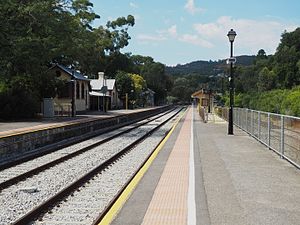
හිමිකාරීත්වයDPTI
ක්‍රියාකරුAdelaide Metro
දුර8.5
වේදිකා ගණන2 Side
දුම්රිය මාර්ග ගණන2
Construction
Structure typeGround
ParkingYes
AccessibleYes
ඉතිහාසය
විවෘතය1883
ප්‍රවාහන නැවතුම්පොල තොරතුරු පැනලය/testcases
General information
Owned byDPTI
Operated byAdelaide Metro
Distance8.5
Platforms2 Side
Tracks2
Construction
Structure typeGround
ParkingYes
AccessibleYes
History
Opened1883
Side by side comparison
{{ප්‍රවාහන නැවතුම්පොල තොරතුරු පැනලය}}{{ප්‍රවාහන නැවතුම්පොල තොරතුරු පැනලය/sandbox}}
ප්‍රවාහන නැවතුම්පොල තොරතුරු පැනලය/testcases
Goodwood Station with the Glenelg Tram overpass.
සාමාන්‍ය තොරතුරු
භූගෝලීය ඛණ්ඩාංක34°57′06″S 138°35′06″E / 34.9515825°S 138.5849102°E / -34.9515825; 138.5849102ඛණ්ඩාංක: 34°57′06″S 138°35′06″E / 34.9515825°S 138.5849102°E / -34.9515825; 138.5849102
හිමිකාරීත්වයDPTI
ක්‍රියාකරුAdelaide Metro
දුර5
වේදිකා ගණන3 (2 Centre)
දුම්රිය මාර්ග ගණන4
Construction
Structure typeGround
ParkingYes
AccessibleNo
ඉතිහාසය
විවෘතය5 March 1883
ප්‍රතිස්ථාපනය1929
ප්‍රවාහන නැවතුම්පොල තොරතුරු පැනලය/testcases
Goodwood Station with the Glenelg Tram overpass.
General information
Coordinates34°57′06″S 138°35′06″E / 34.9515825°S 138.5849102°E / -34.9515825; 138.5849102ඛණ්ඩාංක: 34°57′06″S 138°35′06″E / 34.9515825°S 138.5849102°E / -34.9515825; 138.5849102
Owned byDPTI
Operated byAdelaide Metro
Distance5
Platforms3 (2 Centre)
Tracks4
Construction
Structure typeGround
ParkingYes
AccessibleNo
History
Opened5 March 1883
Rebuilt1929

සැකිල්ල:Hiddenrefs

Pittsburgh Union Station

සංස්කරණය
Side by side comparison
{{ප්‍රවාහන නැවතුම්පොල තොරතුරු පැනලය}}{{ප්‍රවාහන නැවතුම්පොල තොරතුරු පැනලය/sandbox}}
Pittsburgh Union Station
Amtrak inter-city rail station
Services
Preceding station Amtrak Following station
Alliance
toward Chicago
Capitol Limited Connellsville
Terminus Pennsylvanian Greensburg
toward New York
Former services
Lua දෝෂය in package.lua at line 80: module 'Module:Adjacent stations/PennDOT' not found.

Grand Trunk station (Richmond)

සංස්කරණය
Side by side comparison
{{ප්‍රවාහන නැවතුම්පොල තොරතුරු පැනලය}}{{ප්‍රවාහන නැවතුම්පොල තොරතුරු පැනලය/sandbox}}
Richmond
Postcard view of the GTR station in 1915
සාමාන්‍ය තොරතුරු
පිහිටි ස්ථානය739, Rue Principale Nord
Richmond, Quebec
Canada.
භූගෝලීය ඛණ්ඩාංක45°39′54″N 72°08′54″W / 45.66500°N 72.14833°W / 45.66500; -72.14833ඛණ්ඩාංක: 45°39′54″N 72°08′54″W / 45.66500°N 72.14833°W / 45.66500; -72.14833
හිමිකාරීත්වයprivate
Construction
Structure typebrick station building
ඉතිහාසය
විවෘතය1853[2]
වසා දැමීම1994[3]
ප්‍රතිස්ථාපනය1999 restaurant[4]
පෙර පැවති නාමGrand Trunk Railway
Official nameCanadian National Railway Station, Richmond, Quebec
Designated1991
Reference no.6719
Richmond
Postcard view of the GTR station in 1915
General information
Location739, Rue Principale Nord
Richmond, Quebec
Canada.
Coordinates45°39′54″N 72°08′54″W / 45.66500°N 72.14833°W / 45.66500; -72.14833ඛණ්ඩාංක: 45°39′54″N 72°08′54″W / 45.66500°N 72.14833°W / 45.66500; -72.14833
Owned byprivate
Construction
Structure typebrick station building
History
Opened1853[2]
Closed1994[3]
Rebuilt1999 restaurant[4]
Previous namesGrand Trunk Railway
Official nameCanadian National Railway Station, Richmond, Quebec
Designated1991
Reference no.6719

Suseongmot station

සංස්කරණය

සැකිල්ල:Test case table

  1. ^ "Annual Ridership Report – Calendar Year 2017" (PDF). Chicago Transit Authority, Ridership Analysis and Reporting. January 31, 2018. සම්ප්‍රවේශය July 29, 2018. {{cite web}}: Cite has empty unknown parameter: |coauthors= (help)
  2. ^ a b "Saint Lawrence and Atlantic Railway Land Agreement: Memorandum of an Agreement, 1848, Between Betsey Clark and the Saint Lawrence and Atlantic Rail-Road Company". The Identity of English-speaking Quebec in 100 Objects. Quebec Anglophone Heritage Network (QAHN). 1848. සම්ප්‍රවේශය April 8, 2015. In 1853, Richmond became a junction for the Quebec and Richmond Railway line positioned on the east side of the railroad station and the newly named Grand Trunk Railway on the west side of the station.
  3. ^ a b Matthew Farfan. "Railway Stations of the Eastern Townships" (PDF). Townships Heritage WebMagazine. සම්ප්‍රවේශය April 8, 2015. Via Rail service to Richmond and Sherbrooke finally ceased in 1994
  4. ^ a b "La Vieille Gare de Richmond". සම්ප්‍රවේශය April 8, 2015.