ගොනුව:Location Australasia cylindrical.png
මෙම පෙරදසුනෙහි විශාලත්වය: 663 × 600 පික්සල. අනෙකුත් විභේදනයන්: 265 × 240 පික්සල | 530 × 480 පික්සල | 849 × 768 පික්සල | 1,132 × 1,024 පික්සල | 1,704 × 1,542 පික්සල.
මුල් ගොනුව (1,704 × 1,542 පික්සල, ගොනු විශාලත්වය: 187 කි.බ., MIME ශෛලිය: image/png)
සාරාංශය
| විස්තරය |
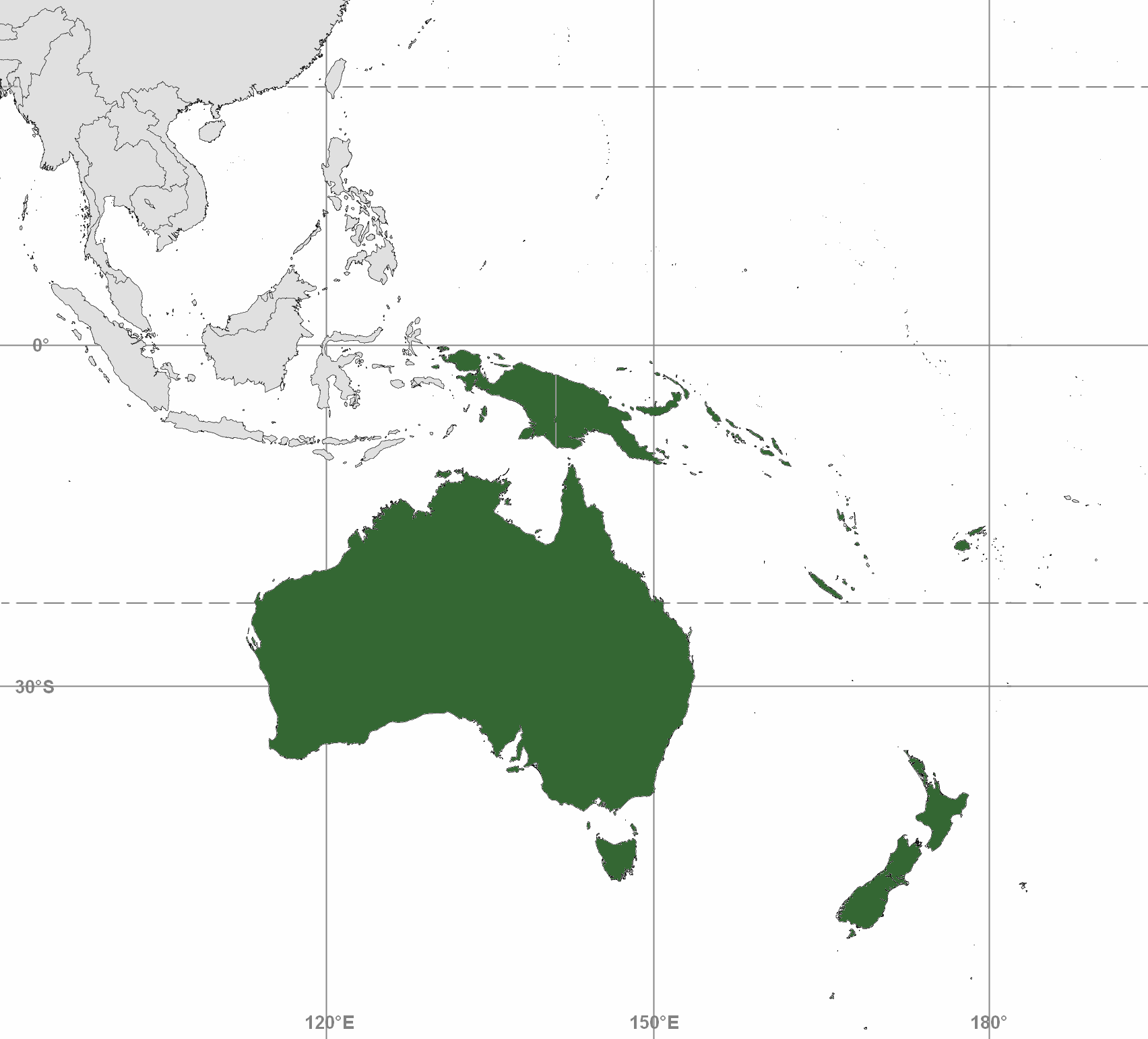
English: Map depicting Australasia; differs from maps for Commonwealth of Australia and Australian continent
Map includes Australia (including Tasmania and Torres Strait Islands); New Zealand; and Melanesia: New Guinea, eastern Aru Islands (as delineated by Lydekker Line), and mainland provinces of Papua New Guinea, Fiji, New Caledonia, Solomon Islands, and Vanuatu. Map adapted from PDF world map at CIA World Fact Book |
| දිනය | |
| මූලාශ්රය |
(a) Blank map contour boundaries: This file was derived from: Pacific-centered mercator bw.svg |
| කර්තෘ |
(a) Blank map: Emok |
බලපත්රීකරණය
මෙම ගොනුව ක්රියේටිව් කොමන්ස් Attribution-Share Alike 3.0 Unported වරපත යටතේ අවසර ලබා ඇත.
- ඔබ නිදහස්:
- බෙදාහදා ගැනීමට – කාර්යය පිටපත් කිරීමට,බෙදා හැරීමට සහ සම්ප්රේෂණය කිරීමට
- නැවත සංකලනය කිරීමට – කාර්යයට අනුවර්තනය වීමට
- පහත කොන්දේසිවලට යටත්ව:
- attribution – වරපත වෙත බැඳියක්ද සපයමින් ඔබ විසින් සුදුසු කර්තෘභාරය ප්රදානය කල යුතු අතර, කිසියම් වෙනස්වීම් සිදුකලේ නම් එයද සඳහන් කල යුතු වෙයි. ඕනෑම සුදුසු ආකාරයට මෙය ඔබ විසින් සිදුකල හැකි මුත්, වරපත්දායකයා විසින් ඔබ හෝ ඔබගේ භාවිතය හෝ පිටසන් කරන බවට ඇඟවෙන ලෙසින් එය සිදු නොකල යුතු වෙයි.
- share alike – මෙම විෂය කාරණා භාවිතා කොට නැවත සංකලනය, ප්රතියෝජනය හෝ වැඩිදියුණුව කලේ නම්, ඉන්පසු ඔබගේ දායකත්වය ඔබ විසින් බෙදාහැරිය යුත්තේ මුල් වරපත හා සමාන හෝ සංගතික හෝ වරපතක් භාවිතා කරමිනි.
ගොනු ඉතිහාසය
එම අවස්ථාවෙහිදී ගොනුව පැවැති ආකාරය නැරඹීමට දිනය/වේලාව මත ක්ලික් කරන්න.
| දිනය/වේලාව | කුඩා-රූපය | මාන | පරිශීලක | පරිකථනය | |
|---|---|---|---|---|---|
| වත්මන් | 15:43, 2 අගෝස්තු 2019 | | 1,704 × 1,542 (187 කි.බ.) | Ham105 | fewer gridlines |
| 10:14, 2 අගෝස්තු 2019 |  | 1,704 × 1,542 (199 කි.බ.) | Ham105 | add lat/long, rm blue bg | |
| 09:20, 2 අගෝස්තු 2019 |  | 1,704 × 1,568 (174 කි.බ.) | Ham105 | Crop | |
| 09:10, 2 අගෝස්තු 2019 |  | 2,007 × 1,889 (222 කි.බ.) | Ham105 | User created page with UploadWizard |
ගොනු භාවිතය
පහත දැක්වෙන පිටුව විසින් මෙම ගොනුව භාවිතා කෙරෙයි:
ගෝලීය ගොනු භාවිතය
පහත දැක්වෙන අනෙකුත් විකියන් මගින් මෙම ගොනුව භාවිතා කරයි:
- bg.wikipedia.org හි භාවිතය
- el.wiktionary.org හි භාවිතය
- en.wikipedia.org හි භාවිතය
- hi.wikipedia.org හි භාවිතය
- ja.wikipedia.org හි භාවිතය
- ko.wikipedia.org හි භාවිතය
- pl.wikipedia.org හි භාවිතය
- th.wikipedia.org හි භාවිතය
- vls.wikipedia.org හි භාවිතය
- zh-min-nan.wikipedia.org හි භාවිතය