ගොනුව:OpenStreetMap Cape Town small.svg

මුල් ගොනුව (SVG ගොනුව, නාමමාත්රිකව 496 × 399 පික්සල්, ගොනු විශාලත්වය: 10.71 මෙ.බ.)
| Description |
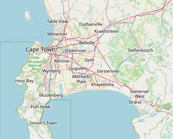
This map of Cape Town was created from OpenStreetMap project data, collected by the community. This map may be incomplete, and may contain errors. Don't rely solely on it for navigation. |
|||||||||
| දිනය | (see file history) | |||||||||
| මූලාශ්රය | openstreetmap.org | |||||||||
| නිර්මාපකයා |
OpenStreetMap contributors |
|||||||||
| අවසරය (මෙම ගොනුව නැවත භාවිතා කරමින්) |
OpenStreetMap data is available under the Open Database License (details). Map tiles are licensed under the Creative Commons Attribution-ShareAlike 2.0 license (CC-BY-SA 2.0).
මෙම ගොනුව නිර්මාණශීලී පොදුවූවන් Attribution-Share Alike 2.0 Generic බලපත්රය යටතේ අවසර ලබා ඇත.
|
|||||||||
| Geotemporal data | ||||||||||
| Bounding box |
|
|||||||||
| Georeferencing | If inappropriate please set warp_status = skip to hide. | |||||||||
derivative works
Derivative works of this file: OpenStreetMap Kaapstad klein Afrikaans.svg
ගොනු ඉතිහාසය
එම අවස්ථාවෙහිදී ගොනුව පැවැති ආකාරය නැරඹීමට දිනය/වේලාව මත ක්ලික් කරන්න.
| දිනය/වේලාව | කුඩා-රූපය | මාන | පරිශීලක | පරිකථනය | |
|---|---|---|---|---|---|
| වත්මන් | 09:11, 16 ජනවාරි 2022 | | 496 × 399 (10.71 මෙ.බ.) | Htonl | customize labels |
| 08:27, 16 ජනවාරි 2022 |  | 496 × 399 (12.15 මෙ.බ.) | Htonl | update | |
| 07:12, 12 ජනවාරි 2011 |  | 424 × 351 (1.71 මෙ.බ.) | Htonl | *tiny* tweak | |
| 07:07, 12 ජනවාරි 2011 |  | 424 × 351 (1.72 මෙ.බ.) | Htonl | bounds | |
| 16:36, 3 පෙබරවාරි 2010 |  | 496 × 399 (2.36 මෙ.බ.) | Htonl | {{OpenStreetMap|location=Cape Town}} Category:OpenStreetMap maps of South Africa |
ගොනු භාවිතය
පහත දැක්වෙන පිටු 3 ක් විසින් මෙම ගොනුව භාවිතා කෙරෙයි:
ගෝලීය ගොනු භාවිතය
පහත දැක්වෙන අනෙකුත් විකියන් මගින් මෙම ගොනුව භාවිතා කරයි:
- af.wikipedia.org හි භාවිතය
- Constantia
- Steenberg
- Athlone
- Bo-Kaap
- Table View
- Goodwood
- Pinelands
- Strand, Wes-Kaap
- Nuweland
- Wynberg
- Rondebosch
- Rosebank, Kaapstad
- Claremont, Kaapstad
- Mowbray
- Zwaanswyk
- Kaapstad Internasionale Lughawe
- Maitland
- Seepunt
- Drieankerbaai
- Brackenfell
- Observatory
- Soutrivier
- Woodstock
- Plumstead
- Llandudno
- Bergvliet
- Bishopscourt
- Heathfield
- Monte Vista
- Lansdowne
- Milnerton
- Kalkbaai
- Noordhoek
- Oranjezicht
- Tamboerskloof
- Hoërskool Durbanville
- Belhar
- Kampsbaai
- Higgovale
- Vredehoek
- Clifton
- Schotsche Kloof
- Zonnebloem
- Mouillepunt
- Elsiesrivier
- Bantrybaai
- Blue Downs
- Crawford
- Ottery
- Mfuleni
මෙම ගොනුවේ තවත් ගෝලීය භාවිත බලන්න.