ගොනුව:North Lanarkshire UK location map.svg

Size of this PNG preview of this SVG file: 509 × 599 පික්සල. අනෙකුත් විභේදනයන්: 204 × 240 පික්සල | 408 × 480 පික්සල | 653 × 768 පික්සල | 870 × 1,024 පික්සල | 1,740 × 2,048 පික්සල | 1,176 × 1,384 පික්සල.
මුල් ගොනුව (SVG ගොනුව, නාමමාත්රිකව 1,176 × 1,384 පික්සල්, ගොනු විශාලත්වය: 1.14 මෙ.බ.)
| විස්තරය |
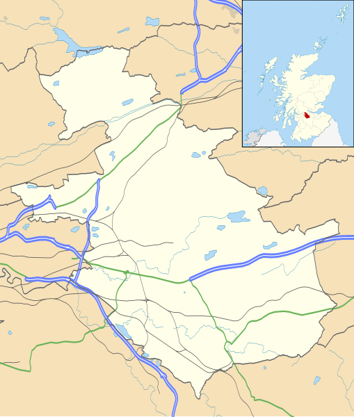
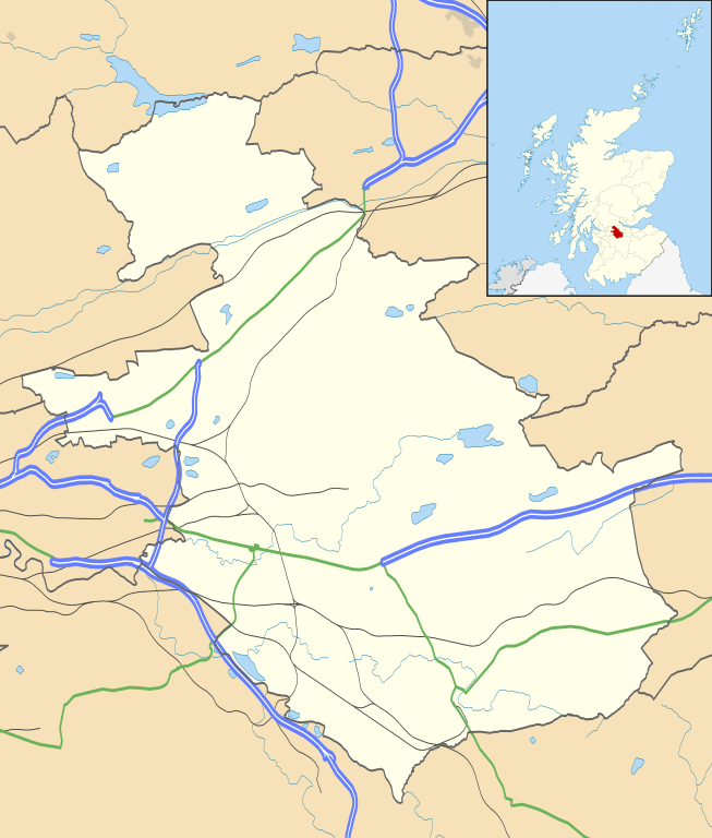
Blank map of North Lanarkshire, UK with the following information shown:
Equirectangular map projection on WGS 84 datum, with N/S stretched 175% Geographic limits:
|
| දිනය | |
| මූලාශ්රය |
|
| කර්තෘ | Nilfanion, created using Ordnance Survey data |
| අවසරය (මෙම ගොනුව නැවත භාවිතා කරමින්) |
මෙම ගොනුව ක්රියේටිව් කොමන්ස් Attribution-Share Alike 3.0 Unported වරපත යටතේ අවසර ලබා ඇත. Attribution: Contains Ordnance Survey data © Crown copyright and database right
|
| අනෙකුත් අනුවාදයන් | File:North Lanarkshire UK blank map.svg - Blank map |
ගොනු ඉතිහාසය
එම අවස්ථාවෙහිදී ගොනුව පැවැති ආකාරය නැරඹීමට දිනය/වේලාව මත ක්ලික් කරන්න.
| දිනය/වේලාව | කුඩා-රූපය | මාන | පරිශීලක | පරිකථනය | |
|---|---|---|---|---|---|
| වත්මන් | 20:20, 26 සැප්තැම්බර් 2010 | | 1,176 × 1,384 (1.14 මෙ.බ.) | Nilfanion | {{Information |Description=Blank map of North Lanarkshire, UK with the following information shown: *Administrative borders *Coastline, lakes and rivers *Roads and railways *Urban areas Equirectangular map projection on WGS 84 dat |
ගොනු භාවිතය
පහත දැක්වෙන පිටු 2 ක් විසින් මෙම ගොනුව භාවිතා කෙරෙයි:
ගෝලීය ගොනු භාවිතය
පහත දැක්වෙන අනෙකුත් විකියන් මගින් මෙම ගොනුව භාවිතා කරයි:
- ar.wikipedia.org හි භාවිතය
- bg.wikipedia.org හි භාවිතය
- ceb.wikipedia.org හි භාවිතය
- de.wikipedia.org හි භාවිතය
- en.wikipedia.org හි භාවිතය
- Airdrie, North Lanarkshire
- North Lanarkshire
- Motherwell
- Coatbridge
- Kilsyth
- Wishaw
- Fir Park
- Bellshill
- Cleland, North Lanarkshire
- Bargeddie
- Excelsior Stadium
- Calderbank
- Abronhill
- Condorrat
- Greenfaulds
- Millerston
- Harthill, Scotland
- Shotts
- Newarthill
- Carfin
- Black Hill transmitting station
- Croy, North Lanarkshire
- Plains, North Lanarkshire
- Cambusnethan
- Coltness
- Newhouse, North Lanarkshire
- University Hospital Monklands
- Broadwood Stadium
- Kirk o' Shotts transmitting station
- Dalserf
- Auchinloch
- Holytown
- Dullatur
- Banton, North Lanarkshire
- Kelvinhead
- Castlecary
- Chryston
- Cliftonhill
- Pather
- Ravenscraig
- Luggiebank
මෙම ගොනුවේ තවත් ගෝලීය භාවිත බලන්න.