ගොනුව:NZ-SI plain map.png

මෙම පෙරදසුනෙහි විශාලත්වය: 530 × 599 පික්සල. අනෙකුත් විභේදනයන්: 212 × 240 පික්සල | 425 × 480 පික්සල | 679 × 768 පික්සල | 1,234 × 1,395 පික්සල.
මුල් ගොනුව (1,234 × 1,395 පික්සල, ගොනු විශාලත්වය: 44 කි.බ., MIME ශෛලිය: image/png)
සාරාංශය
Transwiki approved by: w:en:User:Multichill
| විස්තරය |
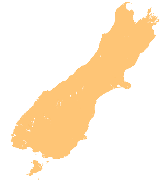
English: template map of New Zealand's South Island |
| දිනය | 3 ජූනි 2007 (original upload date) |
| මූලාශ්රය | Transferred from en.wikipedia to Commons. |
| කර්තෘ | Original uploader was Grutness at en.wikipedia |
බලපත්රීකරණය
| මම, මෙම කාර්යයේ ප්රතිරූපණ අයිති හිමිකරු, මෙම කාර්යය public domain වෙත නිදහස් කරමි. මෙය ලෝක ව්යාප්තව අදාළ වේ. සමහර රටවල මෙය අනීතික විය හැකිය. එසේ වුවහොත්; මම කිසිදු කොන්දේසියකින් තොරව,ඕනෑම අයෙකුට ඕනෑම කාර්යයක් සඳහා මෙය, නීතිමය බාධාවක් නොමැති වනතුරු, භාවිතා කිරීමේ අයිතිය ලබාදෙමි. |
ප්රකෘති පැටවුම් ලොගය
01:40, 3 June 2007 || w:en:User:Grutness || || 116 KB || whoops - that was the small version. Template map of New Zealand's South Island, created by myself from numerous sources {{PD-self}} 01:21, 3 June 2007 || w:en:User:Grutness || 440×497 || 63 KB || template map of New Zealand's South Island {{pd}}| date/time | username | resolution | size | edit summary |
|---|---|---|---|---|
| 01:45, 3 June 2007 | w:en:User:Grutness | 1,234×1,395 | 44 KB | d'oh. That was a photoshop file. |
Image description page history
| link | date/time | username | edit summary |
|---|---|---|---|
| [1] | 13:40, 14 March 2008 | w:en:User:Multichill | |
| [2] | 01:27, 3 June 2007 | w:en:User:Grutness | |
| [3] | 01:21, 3 June 2007 | w:en:User:Grutness | (template map of New Zealand's South Island {{pd}}) |
![[1]](https://en.wikipedia.org/w/index.php?title=Image:NZ-SI_plain_map.png&redirect=no&oldid=198188155)
![[2]](https://en.wikipedia.org/w/index.php?title=Image:NZ-SI_plain_map.png&redirect=no&oldid=135448378)
![[3]](https://en.wikipedia.org/w/index.php?title=Image:NZ-SI_plain_map.png&redirect=no&oldid=135447357)

|
This map image could be re-created using vector graphics as an SVG file. This has several advantages; see Commons:Media for cleanup for more information. If an SVG form of this image is available, please upload it and afterwards replace this template with
{{vector version available|new image name}}.
It is recommended to name the SVG file “NZ-SI plain map.svg”—then the template Vector version available (or Vva) does not need the new image name parameter. |
ගොනු ඉතිහාසය
එම අවස්ථාවෙහිදී ගොනුව පැවැති ආකාරය නැරඹීමට දිනය/වේලාව මත ක්ලික් කරන්න.
| දිනය/වේලාව | කුඩා-රූපය | මාන | පරිශීලක | පරිකථනය | |
|---|---|---|---|---|---|
| වත්මන් | 20:23, 18 මාර්තු 2008 | | 1,234 × 1,395 (44 කි.බ.) | BetacommandBot | Transwiki approved by: w:en:User:Multichill {{Information |Description={{en|template map of New Zealand's South Island Category:Maps of New Zealand}} |Source=Transferred from [http://en.wikipedia.org en.wikipedia] |Date=2007-06-03 (first ve |
ගොනු භාවිතය
පහත දැක්වෙන පිටු 2 ක් විසින් මෙම ගොනුව භාවිතා කෙරෙයි:
ගෝලීය ගොනු භාවිතය
පහත දැක්වෙන අනෙකුත් විකියන් මගින් මෙම ගොනුව භාවිතා කරයි:
- ar.wikipedia.org හි භාවිතය
- ba.wikipedia.org හි භාවිතය
- ceb.wikipedia.org හි භාවිතය
- cs.wikipedia.org හි භාවිතය
- de.wikivoyage.org හි භාවිතය
- en.wikipedia.org හි භාවිතය
- Pearl Harbour, New Zealand
- Lake Manapouri
- Christchurch
- Aan River
- Acheron River (Marlborough)
- Adams River (New Zealand)
- Boulder River (New Zealand)
- Clearwater River (New Zealand)
- Cook River / Weheka
- White River (New Zealand)
- Copland River
- Lake Rotoroa (Tasman)
- Lake Te Anau
- Arawhata River
- Aorere River
- Mangles River
- Lake Dunstan
- Otehake River
- Lake Ellesmere / Te Waihora
- Lake Benmore
- Taieri River
- Waipori River
- Waikouaiti River
- Lake Ruataniwha
- Lake Hāwea
- Lake Ōhau
- Lake Waitaki
- Eglinton River
- Lake Poteriteri
- Lake Monowai
- Lake Hauroko
- Hollyford River
- Ōtira River
- Lake McKerrow
- Taramakau River
- Matiri River
- Owen River
- Ōkārito Lagoon
- Lake Kaniere
- Tākaka River
- Riuwaka River
- Slate River (New Zealand)
- Godley River
- Tasman River
මෙම ගොනුවේ තවත් ගෝලීය භාවිත බලන්න.