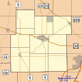
ගොනුව:Location map of Whitley County, Indiana.svg

Size of this PNG preview of this SVG file: 600 × 600 පික්සල. අනෙකුත් විභේදනයන්: 240 × 240 පික්සල | 480 × 480 පික්සල | 768 × 768 පික්සල | 1,024 × 1,024 පික්සල | 2,048 × 2,048 පික්සල | 960 × 960 පික්සල.
මුල් ගොනුව (SVG ගොනුව, නාමමාත්රිකව 960 × 960 පික්සල්, ගොනු විශාලත්වය: 832 කි.බ.)
ගොනු ඉතිහාසය
එම අවස්ථාවෙහිදී ගොනුව පැවැති ආකාරය නැරඹීමට දිනය/වේලාව මත ක්ලික් කරන්න.
| දිනය/වේලාව | කුඩා-රූපය | මාන | පරිශීලක | පරිකථනය | |
|---|---|---|---|---|---|
| වත්මන් | 13:30, 21 අගෝස්තු 2014 |  | 960 × 960 (832 කි.බ.) | Omnedon | == {{int:filedesc}} == {{Information |Description={{en|This is a map of Whitley County, Indiana, USA which includes incorporated settlements, township borders, and major highways.}} |Source=My own work, using custom-writt... |
ගොනු භාවිතය
පහත දැක්වෙන පිටු 2 ක් විසින් මෙම ගොනුව භාවිතා කෙරෙයි:
ගෝලීය ගොනු භාවිතය
පහත දැක්වෙන අනෙකුත් විකියන් මගින් මෙම ගොනුව භාවිතා කරයි:
- ar.wikipedia.org හි භාවිතය
- azb.wikipedia.org හි භාවිතය
- en.wikipedia.org හි භාවිතය
- Collamer, Indiana
- Coesse, Indiana
- Collins, Indiana
- Etna, Indiana
- Peabody, Indiana
- Raber, Indiana
- Tunker, Indiana
- Module:Location map/data/USA Indiana Whitley County
- Module:Location map/data/USA Indiana Whitley County/doc
- Lorane, Indiana
- Ormas, Indiana
- Laud, Indiana
- Washington Center, Indiana
- Coesse Corners, Indiana
- Luther, Indiana
- Dunfee, Indiana
- Cresco, Indiana
- Blue Lake, Indiana
- Five Points, Whitley County, Indiana
- fa.wikipedia.org හි භාවිතය
- fr.wikipedia.org හි භාවිතය