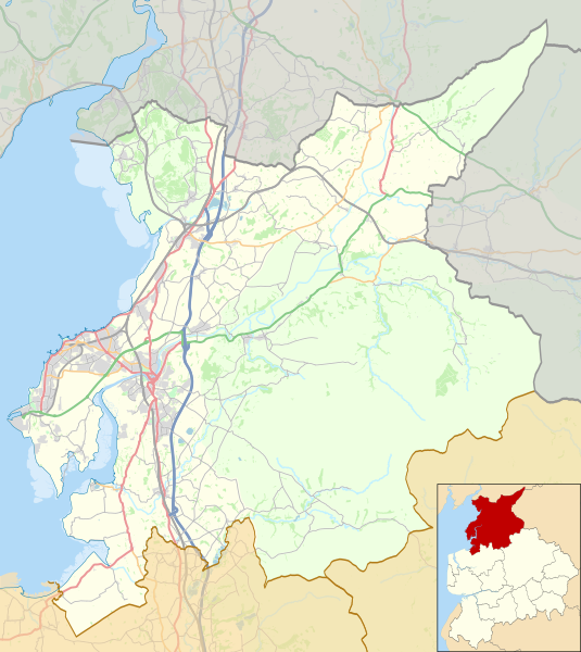
ගොනුව:Location map United Kingdom City of Lancaster.svg

Size of this PNG preview of this SVG file: 535 × 600 පික්සල. අනෙකුත් විභේදනයන්: 214 × 240 පික්සල | 428 × 480 පික්සල | 685 × 768 පික්සල | 913 × 1,024 පික්සල | 1,827 × 2,048 පික්සල | 1,164 × 1,305 පික්සල.
මුල් ගොනුව (SVG ගොනුව, නාමමාත්රිකව 1,164 × 1,305 පික්සල්, ගොනු විශාලත්වය: 5.03 මෙ.බ.)
ගොනු ඉතිහාසය
එම අවස්ථාවෙහිදී ගොනුව පැවැති ආකාරය නැරඹීමට දිනය/වේලාව මත ක්ලික් කරන්න.
| දිනය/වේලාව | කුඩා-රූපය | මාන | පරිශීලක | පරිකථනය | |
|---|---|---|---|---|---|
| වත්මන් | 21:43, 7 මැයි 2018 |  | 1,164 × 1,305 (5.03 මෙ.බ.) | Dr Greg | Some minor colour changes to improve clarity |
| 21:27, 3 මැයි 2017 |  | 1,164 × 1,305 (5.06 මෙ.බ.) | Dr Greg | Added Heysham link road | |
| 22:06, 25 ජූලි 2014 |  | 1,164 × 1,305 (5.03 මෙ.බ.) | Dr Greg | User created page with UploadWizard |
ගොනු භාවිතය
පහත දැක්වෙන පිටු 2 ක් විසින් මෙම ගොනුව භාවිතා කෙරෙයි:
ගෝලීය ගොනු භාවිතය
පහත දැක්වෙන අනෙකුත් විකියන් මගින් මෙම ගොනුව භාවිතා කරයි:
- ar.wikipedia.org හි භාවිතය
- azb.wikipedia.org හි භාවිතය
- en.wikipedia.org හි භාවිතය
- Lancaster, Lancashire
- Leighton Moss RSPB reserve
- Galgate
- Heysham
- Carnforth
- City of Lancaster
- Clougha Pike
- Grit Fell
- Ward's Stone
- Wolfhole Crag
- Bolton-le-Sands
- Capernwray Hall
- White Hill (Forest of Bowland)
- Hawthornthwaite Fell
- Lancaster railway station
- Carnforth railway station
- Silverdale railway station
- Silverdale, Lancashire
- Melling-with-Wrayton
- Heysham Port railway station
- Morecambe railway station
- Bay Horse
- Cockerham
- Halton-with-Aughton
- Abbeystead
- Wennington, Lancashire
- Yealand Conyers
- Yealand Redmayne
- Yealand Storrs
- Arkholme-with-Cawood
- Quernmore
- Whittington, Lancashire
- Borwick
- Overton, Lancashire
- Middleton, Lancashire
- Sunderland, Lancashire
- Wennington railway station
- Slyne-with-Hest
- Dolphinholme
- Warton, Lancaster
- Green Hill (Lancashire)
- Cowan Bridge
- Burrow-with-Burrow
- Wray, Lancashire
- Hornby Castle, Lancashire
- Cockersand Abbey
මෙම ගොනුවේ තවත් ගෝලීය භාවිත බලන්න.


