ගොනුව:India location map2.svg

Size of this PNG preview of this SVG file: 557 × 600 පික්සල. අනෙකුත් විභේදනයන්: 223 × 240 පික්සල | 446 × 480 පික්සල | 713 × 768 පික්සල | 951 × 1,024 පික්සල | 1,902 × 2,048 පික්සල | 1,500 × 1,615 පික්සල.
මුල් ගොනුව (SVG ගොනුව, නාමමාත්රිකව 1,500 × 1,615 පික්සල්, ගොනු විශාලත්වය: 1.69 මෙ.බ.)

|
The boundaries on this map show the de facto situation. This is just one of several different views on the subject (see COM:NPOV). |
සාරාංශය
| විස්තරය |
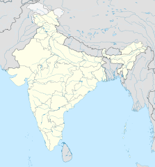
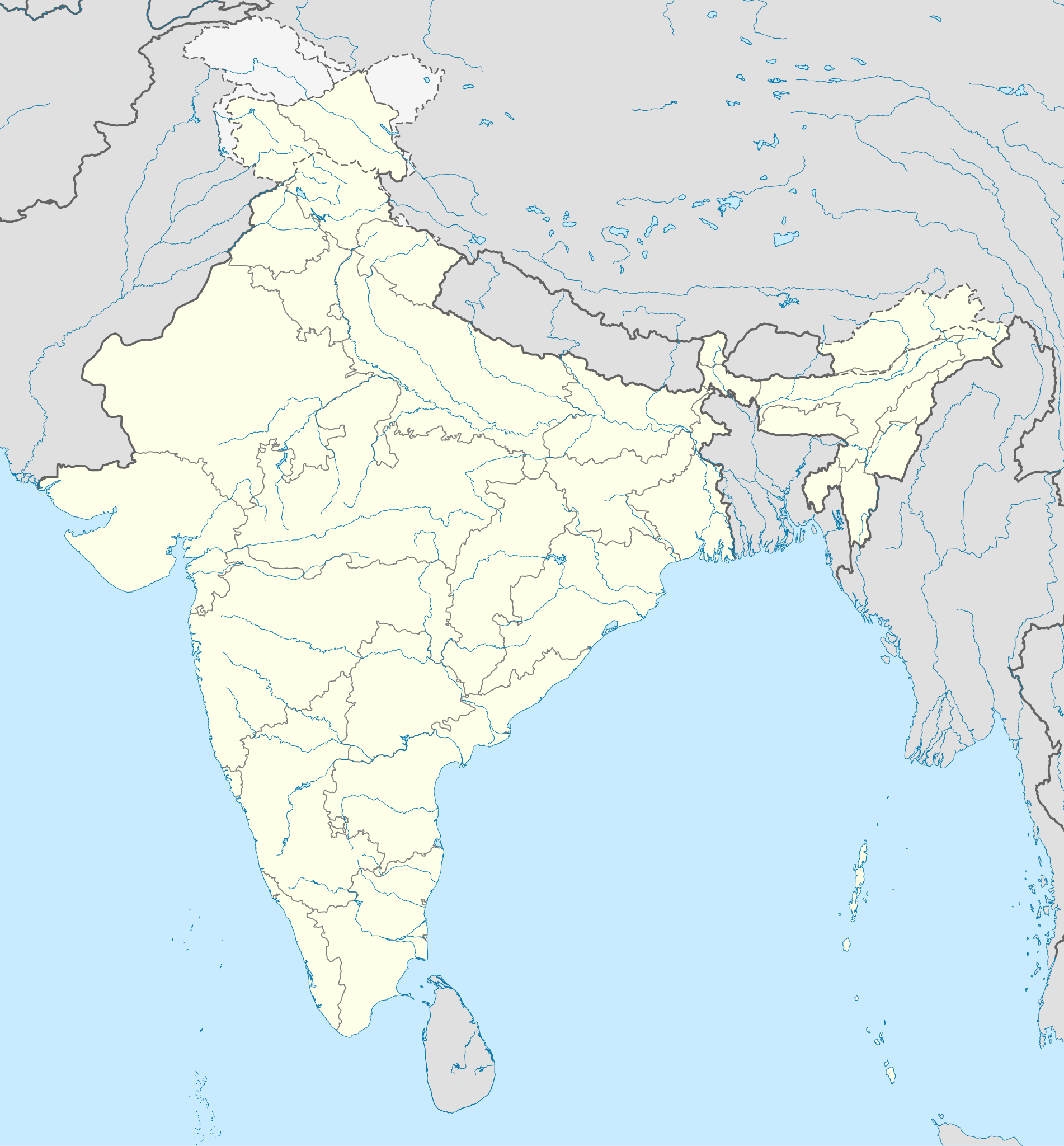
English: Location map of India. Equirectangular projection. Strechted by 106.0%. Geographic limits of the map: * N: 37.5° N * S: 5.0° N * W: 67.0° E * E: 99.0° E Made with Natural Earth. Free vector and raster map data @ naturalearthdata.com. |
| දිනය | |
| මූලාශ්රය | Own work based on: File:India location map.svg by Uwe Dedering at de:Wp |
| කර්තෘ | AshwiniKalantri |
| අනෙකුත් අනුවාදයන් |
[]
|
| SVG genesis |


බලපත්රීකරණය
I, මෙම කාර්යයේ ප්රකාශන අයිතිය දරන්නා,පහත බලපත්රය යටතේ එය ප්රකාශයට පත් කරනු ලබයි:
මෙම ගොනුව ක්රියේටිව් කොමන්ස් Attribution-Share Alike 3.0 Unported වරපත යටතේ අවසර ලබා ඇත.
- ඔබ නිදහස්:
- බෙදාහදා ගැනීමට – කාර්යය පිටපත් කිරීමට,බෙදා හැරීමට සහ සම්ප්රේෂණය කිරීමට
- නැවත සංකලනය කිරීමට – කාර්යයට අනුවර්තනය වීමට
- පහත කොන්දේසිවලට යටත්ව:
- attribution – වරපත වෙත බැඳියක්ද සපයමින් ඔබ විසින් සුදුසු කර්තෘභාරය ප්රදානය කල යුතු අතර, කිසියම් වෙනස්වීම් සිදුකලේ නම් එයද සඳහන් කල යුතු වෙයි. ඕනෑම සුදුසු ආකාරයට මෙය ඔබ විසින් සිදුකල හැකි මුත්, වරපත්දායකයා විසින් ඔබ හෝ ඔබගේ භාවිතය හෝ පිටසන් කරන බවට ඇඟවෙන ලෙසින් එය සිදු නොකල යුතු වෙයි.
- share alike – මෙම විෂය කාරණා භාවිතා කොට නැවත සංකලනය, ප්රතියෝජනය හෝ වැඩිදියුණුව කලේ නම්, ඉන්පසු ඔබගේ දායකත්වය ඔබ විසින් බෙදාහැරිය යුත්තේ මුල් වරපත හා සමාන හෝ සංගතික හෝ වරපතක් භාවිතා කරමිනි.
මෙම ගොනුව උත්පාදක සාර්වයන් Attribution-Share Alike 3.0 Germany වරපත යටතේ අවසර ලබා ඇත.
- ඔබ නිදහස්:
- බෙදාහදා ගැනීමට – කාර්යය පිටපත් කිරීමට,බෙදා හැරීමට සහ සම්ප්රේෂණය කිරීමට
- නැවත සංකලනය කිරීමට – කාර්යයට අනුවර්තනය වීමට
- පහත කොන්දේසිවලට යටත්ව:
- attribution – වරපත වෙත බැඳියක්ද සපයමින් ඔබ විසින් සුදුසු කර්තෘභාරය ප්රදානය කල යුතු අතර, කිසියම් වෙනස්වීම් සිදුකලේ නම් එයද සඳහන් කල යුතු වෙයි. ඕනෑම සුදුසු ආකාරයට මෙය ඔබ විසින් සිදුකල හැකි මුත්, වරපත්දායකයා විසින් ඔබ හෝ ඔබගේ භාවිතය හෝ පිටසන් කරන බවට ඇඟවෙන ලෙසින් එය සිදු නොකල යුතු වෙයි.
- share alike – මෙම විෂය කාරණා භාවිතා කොට නැවත සංකලනය, ප්රතියෝජනය හෝ වැඩිදියුණුව කලේ නම්, ඉන්පසු ඔබගේ දායකත්වය ඔබ විසින් බෙදාහැරිය යුත්තේ මුල් වරපත හා සමාන හෝ සංගතික හෝ වරපතක් භාවිතා කරමිනි.


|
Free Software Foundation විසින් ප්රකාශිත GNU Free Documentation License බලපත්රයෙහි 1.2 හෝ ඊට අලුත් පිටපත්වල කොන්දේසිවලට යටත්ව මෙම ගොනුව පිටපත් කෙරුමට, නැවත බෙදාහාරුමට සහ/හෝ වෙනස් කෙරුමට අවසර දී ඇත; ඒ වෙනස් අංශ නොමැතිව, මුල් පිටු පෙළ නොමැතිව, පසු පිටු පෙළ නොමැතිවය. බලපත්රයේ පිටපතක් GNU Free Documentation License නම් අංශයේ දැක්වේ. |
ඔබට අභිමත වරපත තෝරාගත හැක.
ප්රකෘති පැටවුම් ලොගය
This image is a derivative work of the following images:
- File:India location map.svg licensed with Cc-by-sa-3.0, Cc-by-sa-3.0-de, GFDL
- 2011-01-18T16:10:27Z Uwe Dedering 1500x1615 (2478400 Bytes) Reverted to version as of 15:50, 17 January 2011 and again, layer structure destroyed, and first discuss this!
- 2011-01-17T19:04:20Z AshwiniKalantri 1500x1615 (1593649 Bytes) The disputed land of Kashmir are shown in a different shade.
- 2011-01-17T15:50:03Z Uwe Dedering 1500x1615 (2478400 Bytes) Reverted to version as of 11:34, 22 September 2010 vandalism
- 2011-01-16T23:30:30Z AshwiniKalantri 1500x1615 (2104259 Bytes) {{Information |Description=Location Map of India |Source= |Date= |Author= |Permission= |other_versions= }}
- 2010-09-22T11:34:41Z BishkekRocks 1500x1615 (2478400 Bytes) The area north of the Siachen Glacier is also part of Chinese-controlled Kashmir.
- 2010-08-31T16:36:47Z Uwe Dedering 1500x1615 (2412750 Bytes) Coloured Pakistani-controlled parts of Kashmir in dark grey & Chinese-controlled Kashmir also. no reason to treat them differently.
- 2010-08-31T11:26:31Z AnonyLog 1500x1615 (2104259 Bytes) A lighter shade is used for uniformity with other maps of India and Pakistan on Wikipedia.
- 2010-05-05T16:44:39Z Uwe Dedering 1500x1615 (2412750 Bytes) Reverted to version as of 12:26, 3 March 2010 make them dark-grey if you wish....
- 2010-05-05T15:43:19Z BishkekRocks 1500x1615 (2104259 Bytes) Coloured Pakistani-controlled parts of Kashmir in light grey (like Chinese-controlled Kashmir). Alternatively colour both in dark grey, no reason to treat them differently.
- 2010-03-03T12:26:13Z Uwe Dedering 1500x1615 (2412750 Bytes) {{Information |Description={{en|Location map of India. Equirectangular projection. Strechted by 106.0%. Geographic limits of the map: * N: 37.5° N * S: 5.0° N * W: 67.0° E * E: 99.0° E Made with Natural Earth. Free vector
Uploaded with derivativeFX
ගොනු ඉතිහාසය
එම අවස්ථාවෙහිදී ගොනුව පැවැති ආකාරය නැරඹීමට දිනය/වේලාව මත ක්ලික් කරන්න.
| දිනය/වේලාව | කුඩා-රූපය | මාන | පරිශීලක | පරිකථනය | |
|---|---|---|---|---|---|
| වත්මන් | 13:48, 14 ඔක්තෝබර් 2020 | | 1,500 × 1,615 (1.69 මෙ.බ.) | NordNordWest | upd Telangana/Andhra Pradesh |
| 10:58, 2 නොවැම්බර් 2019 |  | 1,500 × 1,615 (1.65 මෙ.බ.) | NordNordWest | upd Jammu and Kashmir | |
| 08:59, 3 ජූනි 2014 |  | 1,500 × 1,615 (1.63 මෙ.බ.) | NordNordWest | + Telangana | |
| 12:58, 11 ජූනි 2012 |  | 1,500 × 1,615 (1.54 මෙ.බ.) | NordNordWest | adding waterbodies | |
| 20:30, 25 පෙබරවාරි 2011 |  | 1,500 × 1,615 (1.57 මෙ.බ.) | AshwiniKalantri | {{Information |Description={{en|Location map of India. Equirectangular projection. Strechted by 106.0%. Geographic limits of the map: * N: 37.5° N * S: 5.0° N * W: 67.0° E * E: 99.0° E Made with Natural Earth. Free vector and raster map data @ natural |
ගොනු භාවිතය
පහත දැක්වෙන පිටු 2 ක් විසින් මෙම ගොනුව භාවිතා කෙරෙයි:
ගෝලීය ගොනු භාවිතය
පහත දැක්වෙන අනෙකුත් විකියන් මගින් මෙම ගොනුව භාවිතා කරයි:
- als.wikipedia.org හි භාවිතය
- as.wikipedia.org හි භාවිතය
- az.wikipedia.org හි භාවිතය
- bh.wikipedia.org හි භාවිතය
- de.wikipedia.org හි භාවිතය
- Indien
- Varanasi
- Bhopal
- Taj Mahal
- Rajgir
- Dharamsala
- Neu-Delhi
- Mumbai
- Kolkata
- Darjeeling (Stadt)
- Prayagraj
- Ahmedabad
- Chandigarh
- Amritsar
- Chennai
- Bengaluru
- Tharangambadi
- Qadian
- Hyderabad (Indien)
- Kozhikode
- Agartala
- Pune
- Agra
- Auroville
- Hampi
- Sarnath
- Jaipur
- Leh
- Katastrophe von Bhopal
- Mahe (Indien)
- Deoband
- Srinagar
- Vrindavan
- Velha Goa
- Patna
- Bodhgaya
- Madurai
මෙම ගොනුවේ තවත් ගෝලීය භාවිත බලන්න.