ගොනුව:Highland UK location map.svg

Size of this PNG preview of this SVG file: 556 × 600 පික්සල. අනෙකුත් විභේදනයන්: 222 × 240 පික්සල | 445 × 480 පික්සල | 712 × 768 පික්සල | 949 × 1,024 පික්සල | 1,898 × 2,048 පික්සල | 1,320 × 1,424 පික්සල.
මුල් ගොනුව (SVG ගොනුව, නාමමාත්රිකව 1,320 × 1,424 පික්සල්, ගොනු විශාලත්වය: 5.26 මෙ.බ.)
ගොනු ඉතිහාසය
එම අවස්ථාවෙහිදී ගොනුව පැවැති ආකාරය නැරඹීමට දිනය/වේලාව මත ක්ලික් කරන්න.
| දිනය/වේලාව | කුඩා-රූපය | මාන | පරිශීලක | පරිකථනය | |
|---|---|---|---|---|---|
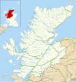
| වත්මන් | 20:20, 26 සැප්තැම්බර් 2010 |  | 1,320 × 1,424 (5.26 මෙ.බ.) | Nilfanion | {{Information |Description=Blank map of Highland, UK with the following information shown: *Administrative borders *Coastline, lakes and rivers *Roads and railways *Urban areas Equirectangular map projection on WGS 84 datum, |
ගොනු භාවිතය
පහත දැක්වෙන පිටු 2 ක් විසින් මෙම ගොනුව භාවිතා කෙරෙයි:
ගෝලීය ගොනු භාවිතය
පහත දැක්වෙන අනෙකුත් විකියන් මගින් මෙම ගොනුව භාවිතා කරයි:
- ar.wikipedia.org හි භාවිතය
- arz.wikipedia.org හි භාවිතය
- ba.wikipedia.org හි භාවිතය
- bg.wikipedia.org හි භාවිතය
- ceb.wikipedia.org හි භාවිතය
- de.wikipedia.org හි භාවිතය
- Kernkraftwerk Dounreay
- Skye Bridge
- Caledonian Stadium
- Neist Point
- Victoria Park (Dingwall)
- Loch Eriboll
- Tarbat Ness Lighthouse
- Ardnamurchan Lighthouse
- Sandwood Bay
- Vorlage:Positionskarte Schottland Highland
- Flughafen Inverness
- Culloden Viaduct
- Fearn Airfield
- Bone Caves
- Wick Airport
- Flugplatz Broadford
- Flugplatz Plockton
- Affric-Beauly-Kraftwerke
- Cromarty Lighthouse
- Leuchtturm Dunnet Head
- Telford Street Park
- Chanonry Lighthouse
- Noss Head Lighthouse
- Cape Wrath Lighthouse
- en.wikipedia.org හි භාවිතය
- Highland (council area)
- List of monastic houses in Scotland
- Inverness
- Plockton
- Knoydart
- Nairn
- Tain
- Grantown-on-Spey
- North Caledonian Football Association
- Carbisdale Castle
- Strontian
- Summer Isles
- Trotternish
- Murlagan
- Badachro
- Ormond Castle
- Dalneigh
- Insh Marshes
- Wick, Caithness
- Inverness Airport
- Achnashellach
මෙම ගොනුවේ තවත් ගෝලීය භාවිත බලන්න.