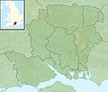
ගොනුව:Hampshire UK relief location map.jpg

මෙම පෙරදසුනෙහි විශාලත්වය: 704 × 599 පික්සල. අනෙකුත් විභේදනයන්: 282 × 240 පික්සල | 564 × 480 පික්සල | 902 × 768 පික්සල | 1,203 × 1,024 පික්සල | 1,999 × 1,702 පික්සල.
මුල් ගොනුව (1,999 × 1,702 පික්සල, ගොනු විශාලත්වය: 407 කි.බ., MIME ශෛලිය: image/jpeg)
ගොනු ඉතිහාසය
එම අවස්ථාවෙහිදී ගොනුව පැවැති ආකාරය නැරඹීමට දිනය/වේලාව මත ක්ලික් කරන්න.
| දිනය/වේලාව | කුඩා-රූපය | මාන | පරිශීලක | පරිකථනය | |
|---|---|---|---|---|---|
| වත්මන් | 01:39, 29 නොවැම්බර් 2011 |  | 1,999 × 1,702 (407 කි.බ.) | Nilfanion | {{Information |Description=Relief map of Hampshire, UK. Equirectangular map projection on WGS 84 datum, with N/S stretched 155% Geographic limits: *West: 2.01W *East: 0.68W *North: 51.41N *South: 50.68N |Source=[[w:Ordnance Survey|Ordnan |
ගොනු භාවිතය
පහත දැක්වෙන පිටු 3 ක් විසින් මෙම ගොනුව භාවිතා කෙරෙයි:
ගෝලීය ගොනු භාවිතය
පහත දැක්වෙන අනෙකුත් විකියන් මගින් මෙම ගොනුව භාවිතා කරයි:
- ar.wikipedia.org හි භාවිතය
- bg.wikipedia.org හි භාවිතය
- ceb.wikipedia.org හි භාවිතය
- en.wikipedia.org හි භාවිතය
- The Solent
- River Hamble
- Twyford Down
- Battle of Alton
- Lymington River
- Battle of the Solent
- Butser Hill
- Pilot Hill, Hampshire
- Battle of Cheriton
- River Alre
- Bartley Water
- Monks Brook
- List of hillforts in England
- Portsmouth and Southsea Synagogue
- Solent Rescue
- Dark Water (river)
- Siege of Basing House
- Gosport and Fareham Inshore Rescue Service
- Ladle Hill
- William Ogle, 1st Viscount Ogle
- Avon Water, Hampshire
- Hayling Island Lifeboat Station
- Portsmouth Lifeboat Station
- Calshot Lifeboat Station
- River Slea, Hampshire
- River Hart
- Philips PFA Golf Classic
- User:Que/sandbox
- Module:Location map/data/United Kingdom Hampshire
- Module:Location map/data/Hampshire
- Module:Location map/data/United Kingdom Hampshire/doc
- Humphrey Bennet
- Fleet Brook
- User:Que/hillforts
- es.wikipedia.org හි භාවිතය
මෙම ගොනුවේ තවත් ගෝලීය භාවිත බලන්න.