ගොනුව:Grenada relief location map.jpg

මෙම පෙරදසුනෙහි විශාලත්වය: 634 × 599 පික්සල. අනෙකුත් විභේදනයන්: 254 × 240 පික්සල | 508 × 480 පික්සල | 813 × 768 පික්සල | 1,084 × 1,024 පික්සල | 1,435 × 1,356 පික්සල.
මුල් ගොනුව (1,435 × 1,356 පික්සල, ගොනු විශාලත්වය: 424 කි.බ., MIME ශෛලිය: image/jpeg)
සාරාංශය
| විස්තරය |
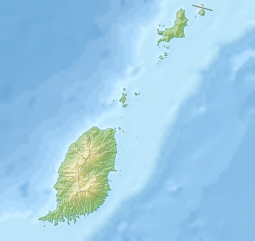
English: Relief location map of Grenada.
|
||
| දිනය | |||
| මූලාශ්රය | ස්වයං නිර්මාණයකි | ||
| කර්තෘ | Uwe Dedering | ||
| අවසරය (මෙම ගොනුව නැවත භාවිතා කරමින්) |
I, මෙම කාර්යයේ ප්රකාශන අයිතිය දරන්නා,පහත බලපත්රය යටතේ එය ප්රකාශයට පත් කරනු ලබයි: මෙම ගොනුව ක්රියේටිව් කොමන්ස් Attribution-Share Alike 3.0 Unported වරපත යටතේ අවසර ලබා ඇත.
ඔබට අභිමත වරපත තෝරාගත හැක. |
||
| අනෙකුත් අනුවාදයන් |
|


ගොනු ඉතිහාසය
එම අවස්ථාවෙහිදී ගොනුව පැවැති ආකාරය නැරඹීමට දිනය/වේලාව මත ක්ලික් කරන්න.
| දිනය/වේලාව | කුඩා-රූපය | මාන | පරිශීලක | පරිකථනය | |
|---|---|---|---|---|---|
| වත්මන් | 11:14, 24 දෙසැම්බර් 2010 | | 1,435 × 1,356 (424 කි.බ.) | Uwe Dedering | initial upload |
ගොනු භාවිතය
පහත දැක්වෙන පිටු 2 ක් විසින් මෙම ගොනුව භාවිතා කෙරෙයි:
ගෝලීය ගොනු භාවිතය
පහත දැක්වෙන අනෙකුත් විකියන් මගින් මෙම ගොනුව භාවිතා කරයි:
- ar.wikipedia.org හි භාවිතය
- ast.wikipedia.org හි භාවිතය
- ba.wikipedia.org හි භාවිතය
- bg.wikipedia.org හි භාවිතය
- bn.wikipedia.org හි භාවිතය
- bs.wikipedia.org හි භාවිතය
- ceb.wikipedia.org හි භාවිතය
- ce.wikipedia.org හි භාවිතය
- ckb.wikipedia.org හි භාවිතය
- cs.wikipedia.org හි භාවිතය
- da.wikipedia.org හි භාවිතය
- de.wikipedia.org හි භාවිතය
- Grenada
- Carriacou
- Mount Saint Catherine
- Petite Martinique
- Vorlage:Positionskarte Grenada
- Wikipedia:Kartenwerkstatt/Positionskarten/Nordamerika
- Benutzer:Uwe Dedering
- Ronde Island
- Lake Antoine
- Grand Etang Lake
- Caille Island
- Diamond Island (Grenada)
- Large Island (Grenada)
- Frigate Island (Carriacou)
- White Island (Grenada)
- Saline Island
- Cassada Rocks
- Mushroom Island (Grenada)
- Sandy Island (Carriacou)
- Mabouya Island
- Sister Rocks (Grenada)
- Bird Island (Grenada)
- Sugarloaf (Grenada)
- Green Island (Grenada)
- Sandy Island (Grenada)
- London Bridge (Grenadinen)
- Bonaparte Rocks
- Rose Rock (Grenada)
- Les Tantes
- Palmiste Lake
- Concord Falls
- Annendale Falls
- Seven Sisters Waterfalls
මෙම ගොනුවේ තවත් ගෝලීය භාවිත බලන්න.