ගොනුව:Finistere department relief location map.jpg
මෙම පෙරදසුනෙහි විශාලත්වය: 639 × 599 පික්සල. අනෙකුත් විභේදනයන්: 256 × 240 පික්සල | 512 × 480 පික්සල | 819 × 768 පික්සල | 1,140 × 1,069 පික්සල.
මුල් ගොනුව (1,140 × 1,069 පික්සල, ගොනු විශාලත්වය: 291 කි.බ., MIME ශෛලිය: image/jpeg)
සාරාංශය
| Camera location | | View this and other nearby images on: OpenStreetMap |
|---|
| විස්තරය |
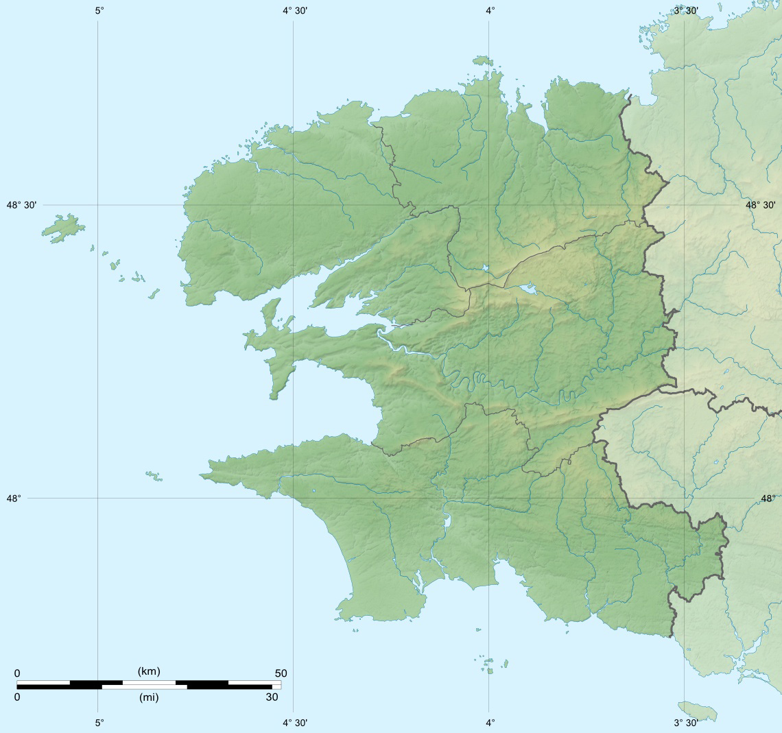
English: Blank physical map of the department of Finistère, France, for geo-location purpose, with distinct boundaries for departments and arrondissements.
Français : Carte physique vierge du département du Finistère, France, destinée à la géolocalisation, avec limite distincte des départements et arrondissements. Scales: 1:520,000 (precision: 130 m) for the topography; 1:7,480,000 (precision: 1,870 m) for the bathymetry
Geographic limits of the map:
|
||
| දිනය | |||
| මූලාශ්රය |
ස්වයං නිර්මාණයකි
|
||
| කර්තෘ | Eric Gaba (Sting - fr:Sting) | ||
| අවසරය (මෙම ගොනුව නැවත භාවිතා කරමින්) |
|
||
| අනෙකුත් අනුවාදයන් |
|

බලපත්රීකරණය
I, මෙම කාර්යයේ ප්රකාශන අයිතිය දරන්නා,පහත බලපත්රය යටතේ එය ප්රකාශයට පත් කරනු ලබයි:
මෙම ගොනුව ක්රියේටිව් කොමන්ස් Attribution-Share Alike 3.0 Unported වරපත යටතේ අවසර ලබා ඇත.
- ඔබ නිදහස්:
- බෙදාහදා ගැනීමට – කාර්යය පිටපත් කිරීමට,බෙදා හැරීමට සහ සම්ප්රේෂණය කිරීමට
- නැවත සංකලනය කිරීමට – කාර්යයට අනුවර්තනය වීමට
- පහත කොන්දේසිවලට යටත්ව:
- attribution – වරපත වෙත බැඳියක්ද සපයමින් ඔබ විසින් සුදුසු කර්තෘභාරය ප්රදානය කල යුතු අතර, කිසියම් වෙනස්වීම් සිදුකලේ නම් එයද සඳහන් කල යුතු වෙයි. ඕනෑම සුදුසු ආකාරයට මෙය ඔබ විසින් සිදුකල හැකි මුත්, වරපත්දායකයා විසින් ඔබ හෝ ඔබගේ භාවිතය හෝ පිටසන් කරන බවට ඇඟවෙන ලෙසින් එය සිදු නොකල යුතු වෙයි.
- share alike – මෙම විෂය කාරණා භාවිතා කොට නැවත සංකලනය, ප්රතියෝජනය හෝ වැඩිදියුණුව කලේ නම්, ඉන්පසු ඔබගේ දායකත්වය ඔබ විසින් බෙදාහැරිය යුත්තේ මුල් වරපත හා සමාන හෝ සංගතික හෝ වරපතක් භාවිතා කරමිනි.

|
Free Software Foundation විසින් ප්රකාශිත GNU Free Documentation License බලපත්රයෙහි 1.2 හෝ ඊට අලුත් පිටපත්වල කොන්දේසිවලට යටත්ව මෙම ගොනුව පිටපත් කෙරුමට, නැවත බෙදාහාරුමට සහ/හෝ වෙනස් කෙරුමට අවසර දී ඇත; ඒ වෙනස් අංශ නොමැතිව, මුල් පිටු පෙළ නොමැතිව, පසු පිටු පෙළ නොමැතිවය. බලපත්රයේ පිටපතක් GNU Free Documentation License නම් අංශයේ දැක්වේ. |
ඔබට අභිමත වරපත තෝරාගත හැක.
ගොනු ඉතිහාසය
එම අවස්ථාවෙහිදී ගොනුව පැවැති ආකාරය නැරඹීමට දිනය/වේලාව මත ක්ලික් කරන්න.
| දිනය/වේලාව | කුඩා-රූපය | මාන | පරිශීලක | පරිකථනය | |
|---|---|---|---|---|---|
| වත්මන් | 22:37, 17 ජූලි 2010 | | 1,140 × 1,069 (291 කි.බ.) | Sting | Color profile |
| 20:20, 8 අගෝස්තු 2008 |  | 1,140 × 1,069 (259 කි.බ.) | Sting | == Summary == {{Location|48|13|30|N|04|15|00|W|scale:1000000}} <br/> {{Information |Description={{en|Blank physical map of the department of Finistère, France, for geo-location purpose, with distinct boundaries for departments and arro |
ගොනු භාවිතය
පහත දැක්වෙන පිටු 2 ක් විසින් මෙම ගොනුව භාවිතා කෙරෙයි:
ගෝලීය ගොනු භාවිතය
පහත දැක්වෙන අනෙකුත් විකියන් මගින් මෙම ගොනුව භාවිතා කරයි:
- als.wikipedia.org හි භාවිතය
- ar.wikipedia.org හි භාවිතය
- br.wikipedia.org හි භාවිතය
- ceb.wikipedia.org හි භාවිතය
- cy.wikipedia.org හි භාවිතය
- de.wikipedia.org හි භාවිතය
- Baie des Trépassés
- Roc’h Trévezel
- Wikipedia Diskussion:WikiProjekt Französische Gemeinden/Archiv/2008
- Wikipedia:Kartenwerkstatt/Positionskarten/Europa
- Île Carn
- Île Guennoc
- Vorlage:Positionskarte Frankreich Finistère
- Vorlage Diskussion:Infobox Gemeinde in Frankreich/Archiv/2008
- Meerenge von Brest
- Wikipedia Diskussion:WikiProjekt Georeferenzierung/Archiv/2010-I
- Burg Trémazan
- Roc’h Ruz
- Ménez-Hom
- Île Melon
- Île Tariec
- Sender Quimerch
- Pointe de Corsen
- Île Callot
- Île Tristan
- Dolmen von Tronval
- Îlot des Capucins
- Île Vierge
- Les Rospects
- Les Étocs
- Anse de Camaret
- Raz de Sein
- el.wikipedia.org හි භාවිතය
- en.wikipedia.org හි භාවිතය
- eo.wikipedia.org හි භාවිතය
මෙම ගොනුවේ තවත් ගෝලීය භාවිත බලන්න.