ගොනුව:China Gansu adm location map.svg

මුල් ගොනුව (SVG ගොනුව, නාමමාත්රිකව 998 × 789 පික්සල්, ගොනු විශාලත්වය: 275 කි.බ.)
සාරාංශය
| විස්තරය |
Deutsch: Positionskarte von Gansu, Volksrepublik China
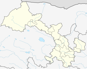
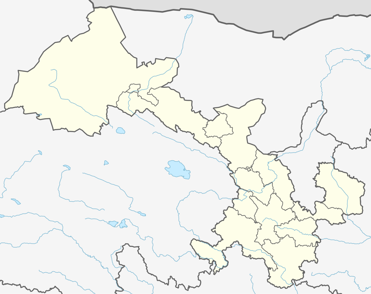
English: Location map of the Gansu, People's Republic of China
|
||||||||||||
| දිනය | |||||||||||||
| මූලාශ්රය |
Own work using:
|
||||||||||||
| කර්තෘ | NordNordWest | ||||||||||||
| අනෙකුත් අනුවාදයන් |
|
||||||||||||


|
This map has been made or improved in the German Kartenwerkstatt (Map Lab). You can propose maps to improve as well.
|
බලපත්රීකරණය
Usage of this file with:

explanatory notes: Legally binding is only the full legalcode. For a free usage I recommend to respect the following licence conditions:
1. Provide my name as given above: NordNordWest,
2. a copy of, or the URI for, the applicable license: https://creativecommons.org/licenses/by-sa/3.0/de/legalcode,
3. the title of the work,
4. in the case of an adaptation, a credit identifying the use of the work in the adaptation.
This license and the rights granted hereunder will terminate automatically upon any breach by you of the terms of this license. Any of the above conditions can be waived if you get permission from the copyright holder. If you have questions or wish differing conditions, please contact me through nnwest or my discussion page ![]() t-online.de
t-online.de
- ඔබ නිදහස්:
- බෙදාහදා ගැනීමට – කාර්යය පිටපත් කිරීමට,බෙදා හැරීමට සහ සම්ප්රේෂණය කිරීමට
- නැවත සංකලනය කිරීමට – කාර්යයට අනුවර්තනය වීමට
- පහත කොන්දේසිවලට යටත්ව:
- attribution – වරපත වෙත බැඳියක්ද සපයමින් ඔබ විසින් සුදුසු කර්තෘභාරය ප්රදානය කල යුතු අතර, කිසියම් වෙනස්වීම් සිදුකලේ නම් එයද සඳහන් කල යුතු වෙයි. ඕනෑම සුදුසු ආකාරයට මෙය ඔබ විසින් සිදුකල හැකි මුත්, වරපත්දායකයා විසින් ඔබ හෝ ඔබගේ භාවිතය හෝ පිටසන් කරන බවට ඇඟවෙන ලෙසින් එය සිදු නොකල යුතු වෙයි.
- share alike – මෙම විෂය කාරණා භාවිතා කොට නැවත සංකලනය, ප්රතියෝජනය හෝ වැඩිදියුණුව කලේ නම්, ඉන්පසු ඔබගේ දායකත්වය ඔබ විසින් බෙදාහැරිය යුත්තේ මුල් වරපත හා සමාන හෝ සංගතික හෝ වරපතක් භාවිතා කරමිනි.

ගොනු ඉතිහාසය
එම අවස්ථාවෙහිදී ගොනුව පැවැති ආකාරය නැරඹීමට දිනය/වේලාව මත ක්ලික් කරන්න.
| දිනය/වේලාව | කුඩා-රූපය | මාන | පරිශීලක | පරිකථනය | |
|---|---|---|---|---|---|
| වත්මන් | 12:15, 12 දෙසැම්බර් 2019 | | 998 × 789 (275 කි.බ.) | NordNordWest | corr |
| 21:02, 11 දෙසැම්බර් 2019 |  | 974 × 789 (284 කි.බ.) | NordNordWest | == {{int:filedesc}} == {{Information |Description= {{de|1=Positionskarte von Gansu, Volksrepublik China}} {{en|1=Location map of the Gansu, People's Republic of China}} {{Location map series N |stretching=126 |top=43 |bottom=32.4 |left=92.5 |right=109 }} |Source={{Own using}} * United States National Imagery and Mapping Agency data * World Data Base II data |Date=2019-12-11 |Author={{U|NordNordWest}} |Permission= |other_versions= }} {{Kartenwerkstatt}} == {{int:license-header}} == {{User:Nor... |
ගොනු භාවිතය
පහත දැක්වෙන පිටු 4 ක් විසින් මෙම ගොනුව භාවිතා කෙරෙයි:
ගෝලීය ගොනු භාවිතය
පහත දැක්වෙන අනෙකුත් විකියන් මගින් මෙම ගොනුව භාවිතා කරයි:
- bn.wikipedia.org හි භාවිතය
- de.wikipedia.org හි භාවිතය
- en.wikipedia.org හි භාවිතය
- Lanzhou
- Jiuquan
- Tianshui
- Xiahe County
- Jiayuguan City
- Linxia City
- Yongjing County
- Hezuo
- Subei Mongol Autonomous County
- Bairi Tibetan Autonomous County
- Baiyin
- Dingxi
- Jinchang
- Wuwei, Gansu
- Dunhuang Mogao International Airport
- Jiayuguan Jiuquan Airport
- Lanzhou Zhongchuan International Airport
- Yongchang County
- Qingyang Airport
- Xifeng, Qingyang
- Longxi County
- Sunan Yugur Autonomous County
- Zhelaizhai
- Chongxin County
- Liangdang County
- Cheng County
- Linxia County
- Kangle County
- Guanghe County
- Hezheng County
- Dongxiang Autonomous County
- Jishishan Bonan, Dongxiang and Salar Autonomous County
- Hui County
- Zhangjiachuan Hui Autonomous County
- Qinzhou, Tianshui
- Jingtai County
- Huining County
- Jingyuan County, Gansu
- Yongdeng County
- Gaolan County
- Yuzhong County
- Gulang County
- Minqin County
මෙම ගොනුවේ තවත් ගෝලීය භාවිත බලන්න.