ගොනුව:Cardiff UK relief location map.jpg

මෙම පෙරදසුනෙහි විශාලත්වය: 561 × 599 පික්සල. අනෙකුත් විභේදනයන්: 225 × 240 පික්සල | 450 × 480 පික්සල | 719 × 768 පික්සල | 959 × 1,024 පික්සල | 2,010 × 2,146 පික්සල.
මුල් ගොනුව (2,010 × 2,146 පික්සල, ගොනු විශාලත්වය: 254 කි.බ., MIME ශෛලිය: image/jpeg)
| විස්තරය |
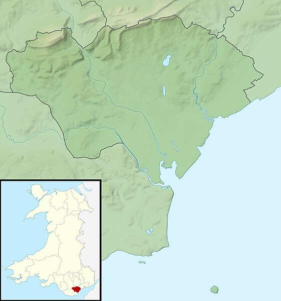
Relief map of Cardiff, UK. Equirectangular map projection on WGS 84 datum, with N/S stretched 160% Geographic limits:
|
| දිනය | |
| මූලාශ්රය |
|
| කර්තෘ | Nilfanion, created using Ordnance Survey data |
| අවසරය (මෙම ගොනුව නැවත භාවිතා කරමින්) |
මෙම ගොනුව ක්රියේටිව් කොමන්ස් Attribution-Share Alike 3.0 Unported වරපත යටතේ අවසර ලබා ඇත. Attribution: Contains Ordnance Survey data © Crown copyright and database right
|
| අනෙකුත් අනුවාදයන් | File:Cardiff UK map.svg - Blank map |
ගොනු ඉතිහාසය
එම අවස්ථාවෙහිදී ගොනුව පැවැති ආකාරය නැරඹීමට දිනය/වේලාව මත ක්ලික් කරන්න.
| දිනය/වේලාව | කුඩා-රූපය | මාන | පරිශීලක | පරිකථනය | |
|---|---|---|---|---|---|
| වත්මන් | 00:56, 30 නොවැම්බර් 2011 | | 2,010 × 2,146 (254 කි.බ.) | Nilfanion | {{Information |Description=Relief map of Cardiff, UK. Equirectangular map projection on WGS 84 datum, with N/S stretched 160% Geographic limits: *West: 3.35W *East: 3.05W *North: 51.57N *South: 51.37N |Source=[[w:Ordnance Survey|Ordnance S |
ගොනු භාවිතය
පහත දැක්වෙන පිටු 2 ක් විසින් මෙම ගොනුව භාවිතා කෙරෙයි:
ගෝලීය ගොනු භාවිතය
පහත දැක්වෙන අනෙකුත් විකියන් මගින් මෙම ගොනුව භාවිතා කරයි:
- ar.wikipedia.org හි භාවිතය
- ceb.wikipedia.org හි භාවිතය
- de.wikipedia.org හි භාවිතය
- el.wikipedia.org හි භාවිතය
- en.wikipedia.org හි භාවිතය
- St Padarn's Institute
- St Fagans Castle
- Animal Wall
- Llanishen Reservoir
- Module:Location map/data/Wales Cardiff/doc
- Lisvane Reservoir
- Bishop's Palace, Llandaff
- Wenallt Camp
- Jackson Hall, Cardiff
- Shah Jalal Mosque, Cardiff
- 6 High Street, Llandaff
- Module:Location map/data/Wales Cardiff
- Ty Bronna
- Craig-y-parc House
- Hayes Island Snack Bar
- Twmpath Castle
- Morganstown Castle Mound
- Caer Castell Camp
- St Andrew, Llandaff
- St Cross, Llandaff
- 19 High Street, Llandaff
- 2-4 High Street, Llandaff
- es.wikipedia.org හි භාවිතය
- fr.wikipedia.org හි භාවිතය
- he.wikipedia.org හි භාවිතය
- hu.wikipedia.org හි භාවිතය
- ja.wikipedia.org හි භාවිතය
- kn.wikipedia.org හි භාවිතය
- ko.wikipedia.org හි භාවිතය
- pl.wikipedia.org හි භාවිතය
- pl.wikibooks.org හි භාවිතය
- sh.wikipedia.org හි භාවිතය
- tr.wikipedia.org හි භාවිතය
- tt.wikipedia.org හි භාවිතය
මෙම ගොනුවේ තවත් ගෝලීය භාවිත බලන්න.