ගොනුව:Canada relief map 2.svg

Size of this PNG preview of this SVG file: 709 × 600 පික්සල. අනෙකුත් විභේදනයන්: 284 × 240 පික්සල | 568 × 480 පික්සල | 908 × 768 පික්සල | 1,211 × 1,024 පික්සල | 2,422 × 2,048 පික්සල | 1,114 × 942 පික්සල.
මුල් ගොනුව (SVG ගොනුව, නාමමාත්රිකව 1,114 × 942 පික්සල්, ගොනු විශාලත්වය: 1.47 මෙ.බ.)
සාරාංශය
| විස්තරය | |
| දිනය | |
| මූලාශ්රය |
ස්වයං නිර්මාණයකි.
|
| කර්තෘ | MapGrid |
| අනෙකුත් අනුවාදයන් |
|
| SVG genesis |


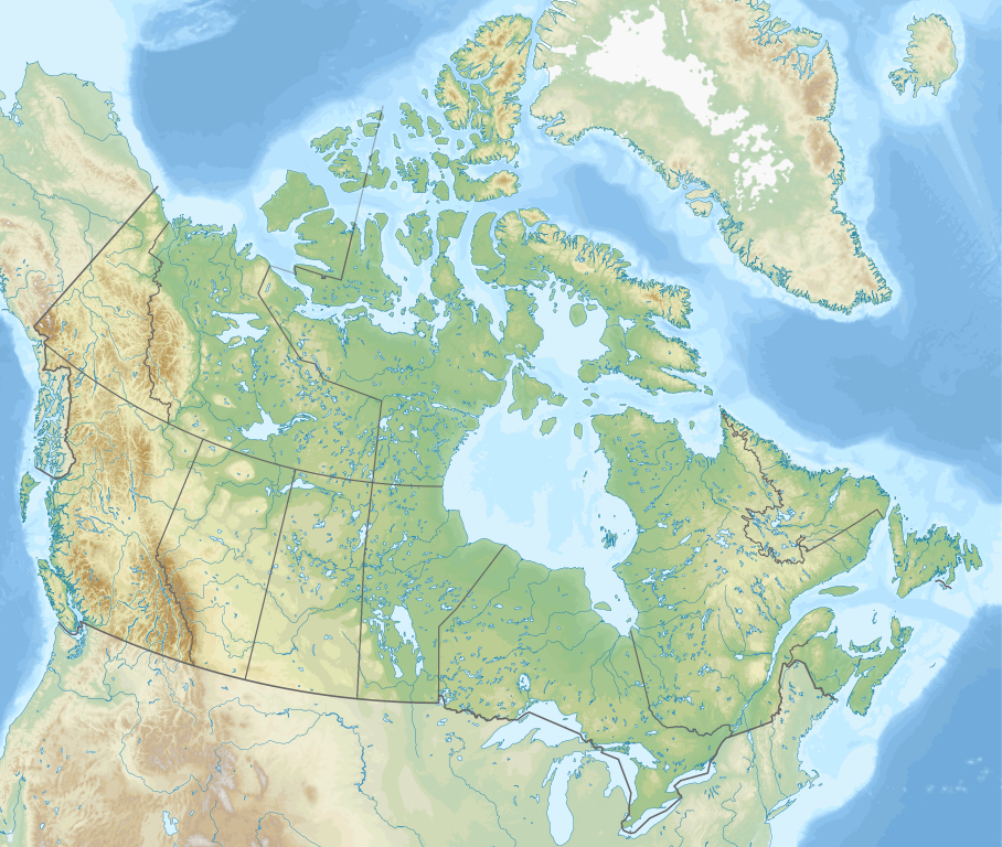
Map Info
| Projection: | Lambert conformal conic |
|---|---|
| Datum: | WGS84 |
| Central Meridian: | 95.000000°W |
| Latitude of Origin: | 60.000000°N |
| Standard Parallel #1: | 49.000000°N |
| Standard Parallel #2: | 77.000000°N |
| x (%)= | 201.7818903*(((tan(pi*(90-$1)/360))*(((1+0.08181919084*sin(pi*$1/180))/(1-0.08181919084*sin(pi*$1/180)))^0.04090959542))^0.9007900864)*sin(0.01572175288*($2+95))+43.98563734
|
|---|---|
| y (%)= | 238.6252927*(((tan(pi*(90-$1)/360))*(((1+0.08181919084*sin(pi*$1/180))/(1-0.08181919084*sin(pi*$1/180)))^0.04090959542))^0.9007900864)*cos(0.01572175288*($2+95))-15.81495465
|
| $1: | latitude in degrees (positive for all locations in Canada). |
| $2: | longitude in degrees (negative for all locations in Canada). |
| x (%): | x coordinate expressed as percentage of image width (measured from left edge). |
| y (%): | y coordinate expressed as percentage of image height (measured from top edge). |
| x (px) | y (px) | x (%) | y (%) | Latitude | Longitude | |
|---|---|---|---|---|---|---|
| Top Left Corner: | 0.000 | 0.000 | 0.00 | 0.00 | 68.220310°N | 176.138684°W |
| Top Right Corner: | 1114.000 | 0.000 | 100.00 | 0.00 | 62.238635°N | 9.994317°W |
| Bottom Right Corner: | 1114.000 | 942.000 | 100.00 | 100.00 | 34.831244°N | 61.953430°W |
| Bottom Left Corner: | 0.000 | 942.000 | 0.00 | 100.00 | 37.392537°N | 121.850536°W |
| Centre: | 557.000 | 471.000 | 50.00 | 50.00 | 63.068962°N | 88.152750°W |
| Origin: | 490.000 | 541.000 | 43.99 | 57.43 | 60.000000°N | 95.000000°W |
| North Pole: | 490.000 | -148.977 | 43.99 | -15.81 | 90.000000°N | ⸻ |
| Thechàl Dhâl: | 67.523 | 368.241 | 6.06 | 39.09 | 61.022873°N | 138.564925°W |
-R-121.85053574/37.39253661/-9.99431686/62.23863537r -JL-95.00000000/60.00000000/49.00000000/77.00000000/29.70666667i |
බලපත්රීකරණය
මෙම කෘතියෙහි හිමිකම් අයිතීන් දරන්නා වන මම,පහත වරපත යටතේ එය ප්රකාශයට පත් කරමි:
This file is licensed under the Creative Commons Attribution-Share Alike 4.0 International license.
- ඔබ නිදහස්:
- බෙදාහදා ගැනීමට – කාර්යය පිටපත් කිරීමට,බෙදා හැරීමට සහ සම්ප්රේෂණය කිරීමට
- නැවත සංකලනය කිරීමට – කාර්යයට අනුවර්තනය වීමට
- පහත කොන්දේසිවලට යටත්ව:
- attribution – වරපත වෙත බැඳියක්ද සපයමින් ඔබ විසින් සුදුසු කර්තෘභාරය ප්රදානය කල යුතු අතර, කිසියම් වෙනස්වීම් සිදුකලේ නම් එයද සඳහන් කල යුතු වෙයි. ඕනෑම සුදුසු ආකාරයට මෙය ඔබ විසින් සිදුකල හැකි මුත්, වරපත්දායකයා විසින් ඔබ හෝ ඔබගේ භාවිතය හෝ පිටසන් කරන බවට ඇඟවෙන ලෙසින් එය සිදු නොකල යුතු වෙයි.
- share alike – මෙම විෂය කාරණා භාවිතා කොට නැවත සංකලනය, ප්රතියෝජනය හෝ වැඩිදියුණුව කලේ නම්, ඉන්පසු ඔබගේ දායකත්වය ඔබ විසින් බෙදාහැරිය යුත්තේ මුල් වරපත හා සමාන හෝ සංගතික හෝ වරපතක් භාවිතා කරමිනි.
ගොනු ඉතිහාසය
එම අවස්ථාවෙහිදී ගොනුව පැවැති ආකාරය නැරඹීමට දිනය/වේලාව මත ක්ලික් කරන්න.
| දිනය/වේලාව | කුඩා-රූපය | මාන | පරිශීලක | පරිකථනය | |
|---|---|---|---|---|---|
| වත්මන් | 17:44, 29 දෙසැම්බර් 2020 | | 1,114 × 942 (1.47 මෙ.බ.) | MapGrid | added an international boundary line between Canada and St Pierre & Miquelon |
| 19:03, 25 දෙසැම්බර් 2020 |  | 1,114 × 942 (1.47 මෙ.බ.) | MapGrid | Christmas Day edition... more rivers | |
| 18:50, 15 නොවැම්බර් 2020 |  | 1,114 × 942 (1.47 මෙ.බ.) | MapGrid | Uploaded own work with UploadWizard |
ගොනු භාවිතය
පහත දැක්වෙන පිටු 4 ක් විසින් මෙම ගොනුව භාවිතා කෙරෙයි:
ගෝලීය ගොනු භාවිතය
පහත දැක්වෙන අනෙකුත් විකියන් මගින් මෙම ගොනුව භාවිතා කරයි:
- azb.wikipedia.org හි භාවිතය
- ban.wikipedia.org හි භාවිතය
- Taman Nasional Jasper
- Taman Nasional Banff
- Taman Nasional Glétsér (Kanada)
- Taman Nasional Cagar Palemahan Nahanni
- Taman Nasional miwah Cagar Palemahan Kluane
- Taman Nasional Wood Buffalo
- Taman Nasional Gros Morne
- Taman Nasional Aulavik
- Taman Nasional Auyuittuq
- Taman Nasional Grasslands
- Taman Nasional Cagar Palemahan Pagunungan Mealy
- Taman Nasional Samenanjung Bruce
- Taman Nasional Dataran Duur Cape Breton
- Taman Nasional Nusa Élk
- Taman Nasional Forillon
- Taman Nasional Kapuloan Celuk Georgian
- Taman Nasional Ivvavik
- Taman Nasional Cagar Palemahan Kapuloan Celuk
- Taman Nasional Cagar Palemahan Gwaii Haanas miwah Situs Tetamian Haida
- Taman Nasional Kootenay
- Taman Nasional Yoho
- Taman Nasional Sirmilik
- Taman Nasional Cagar Palemahan Lingkeh Pasifik
- Taman Nasional Danu Waterton
- Taman Nasional Cagar Palemahan Thaidene Nëné
- Taman Nasional Kejimkujik
- Taman Nasional La Mauricie
- Taman Nasional Cagar Palemahan Kapuloan Mingan
- Taman Nasional Gunung Revelstoke
- Taman Nasional Cagar Palemahan Náts'ihch'oh
- Taman Nasional Nusa Rajaputra Edward
- Taman Nasional Pukaskwa
- Taman Nasional Qausuittuq
- Taman Nasional Gunung Riding
- Taman Nasional Térra Nova
- Taman Nasional Thousand Islands
- Taman Nasional Pagunungan Torngat
- Taman Nasional Tuktut Nogait
- Lapangan BMO
- bg.wikipedia.org හි භාවිතය
මෙම ගොනුවේ තවත් ගෝලීය භාවිත බලන්න.