ගොනුව:Boven-Surinamerivier, met Gran en Pikin Rio.png
මෙයට ඉහල විසර්ජනයක් ලබාගත නොහැක.
Boven-Surinamerivier,_met_Gran_en_Pikin_Rio.png (292 × 542 පික්සල, ගොනු විශාලත්වය: 19 කි.බ., MIME ශෛලිය: image/png)
සාරාංශය
| විස්තරය |
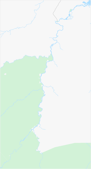
Nederlands: Boven-Surinamerivier, inclusief de benedenloop van de Gran Rio en Pikin Rio
English: Upper-Suriname River, including downstream Gran Rio and Pikin Rio |
|||||||||||||||
| දිනය | ||||||||||||||||
| මූලාශ්රය | www.openstreetmap.org, 4.565 North, -55.62 West -55.28 East -3.84 South | |||||||||||||||
| කර්තෘ | OpenStreetMap contributors | |||||||||||||||
| අවසරය (මෙම ගොනුව නැවත භාවිතා කරමින්) |
|
|||||||||||||||
| අනෙකුත් අනුවාදයන් |

ගොනු ඉතිහාසය
එම අවස්ථාවෙහිදී ගොනුව පැවැති ආකාරය නැරඹීමට දිනය/වේලාව මත ක්ලික් කරන්න.
| දිනය/වේලාව | කුඩා-රූපය | මාන | පරිශීලක | පරිකථනය | |
|---|---|---|---|---|---|
| වත්මන් | 09:56, 6 අප්රේල් 2022 | | 292 × 542 (19 කි.බ.) | Ymnes | == {{int:filedesc}} == {{Information |Description={{nl|Boven-Surinamerivier, inclusief de benedenloop van de Gran Rio en Pikin Rio}} {{en|Upper-Suriname River, including downstream Gran Rio and Pikin Rio}} |Source=[https://www.openstreetmap.org/#map=10/4.2101/-55.5922&layers=T www.openstreetmap.org], 4.58 North, -55.62 West -55.22 East -3.84 South |Date=2022-04-06 |Author=OpenStreetMap contributors |Permission={{OpenStreetMap}} |other_versions= }} Category:Location maps of Suriname |
| 09:21, 6 අප්රේල් 2022 |  | 248 × 531 (17 කි.බ.) | Ymnes | == {{int:filedesc}} == {{Information |Description={{nl|Boven-Surinamerivier, inclusief de benedenloop van de Gran Rio en Pikin Rio}} {{en|Upper-Suriname River, including downstream Gran Rio and Pikin Rio}} |Source=[https://www.openstreetmap.org https://www.openstreetmap.org/#map=10/4.3026/-55.7089&layers=T], 4.565 North, -55.62 West, -55.28 East, 3.84 South |Date=2022-04-06 |Author=OpenStreetMap contributors |Permission={{OpenStreetMap}} |other_versions= }} Category:Location maps of Suriname | |
| 08:52, 6 අප්රේල් 2022 |  | 277 × 560 (18 කි.බ.) | Ymnes | {{Information |Description={{nl|Boven-Surinamerivier, inclusief de benedenloop van de Gran Rio en Pikin Rio}} {{en|Upper-Suriname River, including downstream Gran Rio and Pikin Rio}} |Source=[https://www.openstreetmap.org www.openstreetmap.org], 4.565 North, -55.62 West, -55.28 East, 3.84 South |Date=2022-04-06 |Author=OpenStreetMap contributors |Permission={{OpenStreetMap}} |other_versions= }} Category:Location maps of Suriname |
ගොනු භාවිතය
පහත දැක්වෙන පිටු 2 ක් විසින් මෙම ගොනුව භාවිතා කෙරෙයි:
ගෝලීය ගොනු භාවිතය
පහත දැක්වෙන අනෙකුත් විකියන් මගින් මෙම ගොනුව භාවිතා කරයි:
- en.wikipedia.org හි භාවිතය
- nl.wikipedia.org හි භාවිතය