ගොනුව:Egypt relief location map.jpg

මෙම පෙරදසුනෙහි විශාලත්වය: 650 × 599 පික්සල. අනෙකුත් විභේදනයන්: 260 × 240 පික්සල | 520 × 480 පික්සල | 833 × 768 පික්සල | 1,055 × 973 පික්සල.
මුල් ගොනුව (1,055 × 973 පික්සල, ගොනු විශාලත්වය: 459 කි.බ., MIME ශෛලිය: image/jpeg)
සාරාංශය
| විස්තරය |
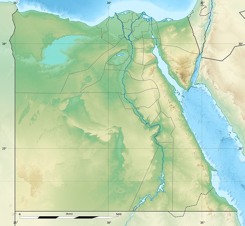
Deutsch: Relief Positionskarte von Ägypten
English: Physical location map of Egypt.
Français : Carte physique vierge destinée à la géolocalisation de l'Égypte telle que depuis le 14 avril 2011 suite à la dissolution des gouvernorats du 6 Octobre et de Helwan. Topographic scale: 1:4,932,000 (precision: 1,233 m)
Geographic limits of the map:
|
||
| දිනය | 2010-03, updated 2014-06 | ||
| මූලාශ්රය |
Topographic background map: Own work
|
||
| කර්තෘ | Eric Gaba (Sting - fr:Sting) and NordNordWest | ||
| අවසරය (මෙම ගොනුව නැවත භාවිතා කරමින්) |
|
||
| අනෙකුත් අනුවාදයන් |
Derivative works of this file: Lower Egypt ancient nomes position map.jpg
|


| Camera location | | View this and other nearby images on: OpenStreetMap |
|---|

|
This map has been made or improved in the German Kartenwerkstatt (Map Lab). You can propose maps to improve as well.
|
බලපත්රීකරණය
I, මෙම කාර්යයේ ප්රකාශන අයිතිය දරන්නා,පහත බලපත්රය යටතේ එය ප්රකාශයට පත් කරනු ලබයි:

|
Free Software Foundation විසින් ප්රකාශිත GNU Free Documentation License බලපත්රයෙහි 1.2 හෝ ඊට අලුත් පිටපත්වල කොන්දේසිවලට යටත්ව මෙම ගොනුව පිටපත් කෙරුමට, නැවත බෙදාහාරුමට සහ/හෝ වෙනස් කෙරුමට අවසර දී ඇත; ඒ වෙනස් අංශ නොමැතිව, මුල් පිටු පෙළ නොමැතිව, පසු පිටු පෙළ නොමැතිවය. බලපත්රයේ පිටපතක් GNU Free Documentation License නම් අංශයේ දැක්වේ. |
මෙම ගොනුව ක්රියේටිව් කොමන්ස් Attribution-Share Alike 3.0 Unported වරපත යටතේ අවසර ලබා ඇත.
- ඔබ නිදහස්:
- බෙදාහදා ගැනීමට – කාර්යය පිටපත් කිරීමට,බෙදා හැරීමට සහ සම්ප්රේෂණය කිරීමට
- නැවත සංකලනය කිරීමට – කාර්යයට අනුවර්තනය වීමට
- පහත කොන්දේසිවලට යටත්ව:
- attribution – වරපත වෙත බැඳියක්ද සපයමින් ඔබ විසින් සුදුසු කර්තෘභාරය ප්රදානය කල යුතු අතර, කිසියම් වෙනස්වීම් සිදුකලේ නම් එයද සඳහන් කල යුතු වෙයි. ඕනෑම සුදුසු ආකාරයට මෙය ඔබ විසින් සිදුකල හැකි මුත්, වරපත්දායකයා විසින් ඔබ හෝ ඔබගේ භාවිතය හෝ පිටසන් කරන බවට ඇඟවෙන ලෙසින් එය සිදු නොකල යුතු වෙයි.
- share alike – මෙම විෂය කාරණා භාවිතා කොට නැවත සංකලනය, ප්රතියෝජනය හෝ වැඩිදියුණුව කලේ නම්, ඉන්පසු ඔබගේ දායකත්වය ඔබ විසින් බෙදාහැරිය යුත්තේ මුල් වරපත හා සමාන හෝ සංගතික හෝ වරපතක් භාවිතා කරමිනි.
ඔබට අභිමත වරපත තෝරාගත හැක.
ගොනු ඉතිහාසය
එම අවස්ථාවෙහිදී ගොනුව පැවැති ආකාරය නැරඹීමට දිනය/වේලාව මත ක්ලික් කරන්න.
| දිනය/වේලාව | කුඩා-රූපය | මාන | පරිශීලක | පරිකථනය | |
|---|---|---|---|---|---|
| වත්මන් | 14:01, 18 අගෝස්තු 2017 | | 1,055 × 973 (459 කි.බ.) | Mélomène | According with [https://en.wikipedia.org/wiki/Hala%27ib_Triangle] |
| 19:53, 13 ජූනි 2014 |  | 1,055 × 973 (450 කි.බ.) | Sting | Color profile | |
| 19:43, 13 ජූනි 2014 |  | 1,055 × 973 (422 කි.බ.) | Sting | Updated Governorates borders shape | |
| 13:59, 18 අප්රේල් 2011 |  | 1,055 × 975 (415 කි.බ.) | Sting | Updated after Governorats dissolution | |
| 13:30, 19 ජූලි 2010 |  | 1,055 × 973 (451 කි.බ.) | Sting | Color profile | |
| 19:04, 7 මාර්තු 2010 |  | 1,055 × 973 (450 කි.බ.) | Sting | == {{int:filedesc}} == {{Location|26|42|00|N|30|45|00|E|scale:10000000}} <br/> {{Information |Description= {{de|Relief Positionskarte von Ägypten}} {{en|Physical location map of Egypt.}} {{fr|Carte physique vierge de l'[[:f |
ගොනු භාවිතය
පහත දැක්වෙන පිටු 10 ක් විසින් මෙම ගොනුව භාවිතා කෙරෙයි:
ගෝලීය ගොනු භාවිතය
පහත දැක්වෙන අනෙකුත් විකියන් මගින් මෙම ගොනුව භාවිතා කරයි:
- als.wikipedia.org හි භාවිතය
- ar.wikipedia.org හි භාවිතය
- arz.wikipedia.org හි භාවිතය
- ast.wikipedia.org හි භාවිතය
- Mar Roxu
- Canal de Suez
- Colosos de Coptos
- Faru d'Alexandría
- Muséu Exipcianu d'El Cairu
- Pirámides d'Exiptu
- Presa d'Asuán
- El Cairu
- Columna de Pompeyo
- Templu de Ramsés II (Abu Simbel)
- Módulu:Mapa de llocalización/datos/Exiptu
- Menfis
- Valle de los Reis
- Ilesia ortodoxa d'Alexandría
- Canal de los Faraones
- Biblioteca d'Alexandría
- Universidá d'al-Azhar
- Universidá d'El Cairu
- Alexandría
- Golfu d'Áqaba
- Gran Pirámide de Guiza
- Catacumbes de Kom el Shogafa
- Ciudadela d'El Cairu
- Península del Sinaí
- Abu Simbel
- Bibliotheca Alexandrina
- Templu d'Edfu
- Módulu:Mapa de llocalización/datos/Exiptu/usu
- Estadiu Internacional d'El Cairu
- KV63
- Damieta
- Cueva de les Besties
- Elefantina
- Gran Muséu Exipciu
මෙම ගොනුවේ තවත් ගෝලීය භාවිත බලන්න.