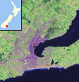
ගොනුව:Dunedin, New Zealand location map.PNG
Dunedin,_New_Zealand_location_map.PNG (421 × 436 පික්සල, ගොනු විශාලත්වය: 236 කි.බ., MIME ශෛලිය: image/png)
ගොනු ඉතිහාසය
එම අවස්ථාවෙහිදී ගොනුව පැවැති ආකාරය නැරඹීමට දිනය/වේලාව මත ක්ලික් කරන්න.
| දිනය/වේලාව | කුඩා-රූපය | මාන | පරිශීලක | පරිකථනය | |
|---|---|---|---|---|---|
| වත්මන් | 12:00, 24 මාර්තු 2010 |  | 421 × 436 (236 කි.බ.) | Benchill | using standard map colours |
| 05:53, 24 මාර්තු 2010 |  | 421 × 436 (236 කි.බ.) | Benchill | {{Information |Description={{en|Satellite photo location map of Dunedin, New Zealand. Based on en:File:DunedinSatmap.png by James Dignan, en:User:Grutness, satellite photo from en:File:Otago harbour landsat.jpg / NASA World Wind Landsat dat |
ගොනු භාවිතය
පහත දැක්වෙන පිටු 2 ක් විසින් මෙම ගොනුව භාවිතා කෙරෙයි:
ගෝලීය ගොනු භාවිතය
පහත දැක්වෙන අනෙකුත් විකියන් මගින් මෙම ගොනුව භාවිතා කරයි:
- ar.wikipedia.org හි භාවිතය
- ca.wikipedia.org හි භාවිතය
- ceb.wikipedia.org හි භාවිතය
- en.wikipedia.org හි භාවිතය
- fa.wikipedia.org හි භාවිතය
- fr.wikipedia.org හි භාවිතය
- ja.wikipedia.org හි භාවිතය
- kn.wikipedia.org හි භාවිතය
- ko.wikipedia.org හි භාවිතය
- simple.wikipedia.org හි භාවිතය
- uz.wikipedia.org හි භාවිතය
- war.wikipedia.org හි භාවිතය